Top hiking trails to explore in West Iceland in the summer of 2026

Before setting off, it’s important to check the Icelandic Meteorological Office website for the latest forecast. If poor weather is expected—especially wind speeds exceeding 18 m/s—it’s best to postpone or adjust your plans. You should also visit the Safe Travel website to ensure your trip is well-prepared and safe.
☀️ Summer Hiking Tips for West Iceland
- Midnight sun: Expect long daylight hours—great for flexible hiking times.
- Weather: Still unpredictable—pack layers and waterproof gear.
- Safety: Check trail conditions and weather at safetravel.is.
- Respect nature: Stay on marked paths to protect fragile landscapes.
Always keep a close eye on the weather, as conditions in Iceland can change rapidly with little warning. Before heading out, make sure to review both the forecast and the trail conditions, and carefully consider the equipment you’ll need. Essential gear includes warm layers, sturdy hiking boots, gloves, a hat, and other protective clothing, along with a GPS device. Pack a backpack with food, water, extra clothing, and a basic first aid kit.
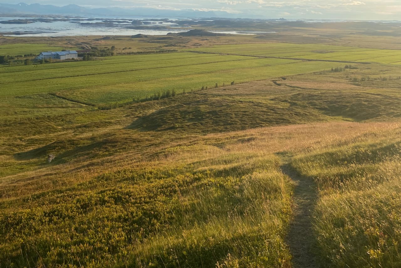
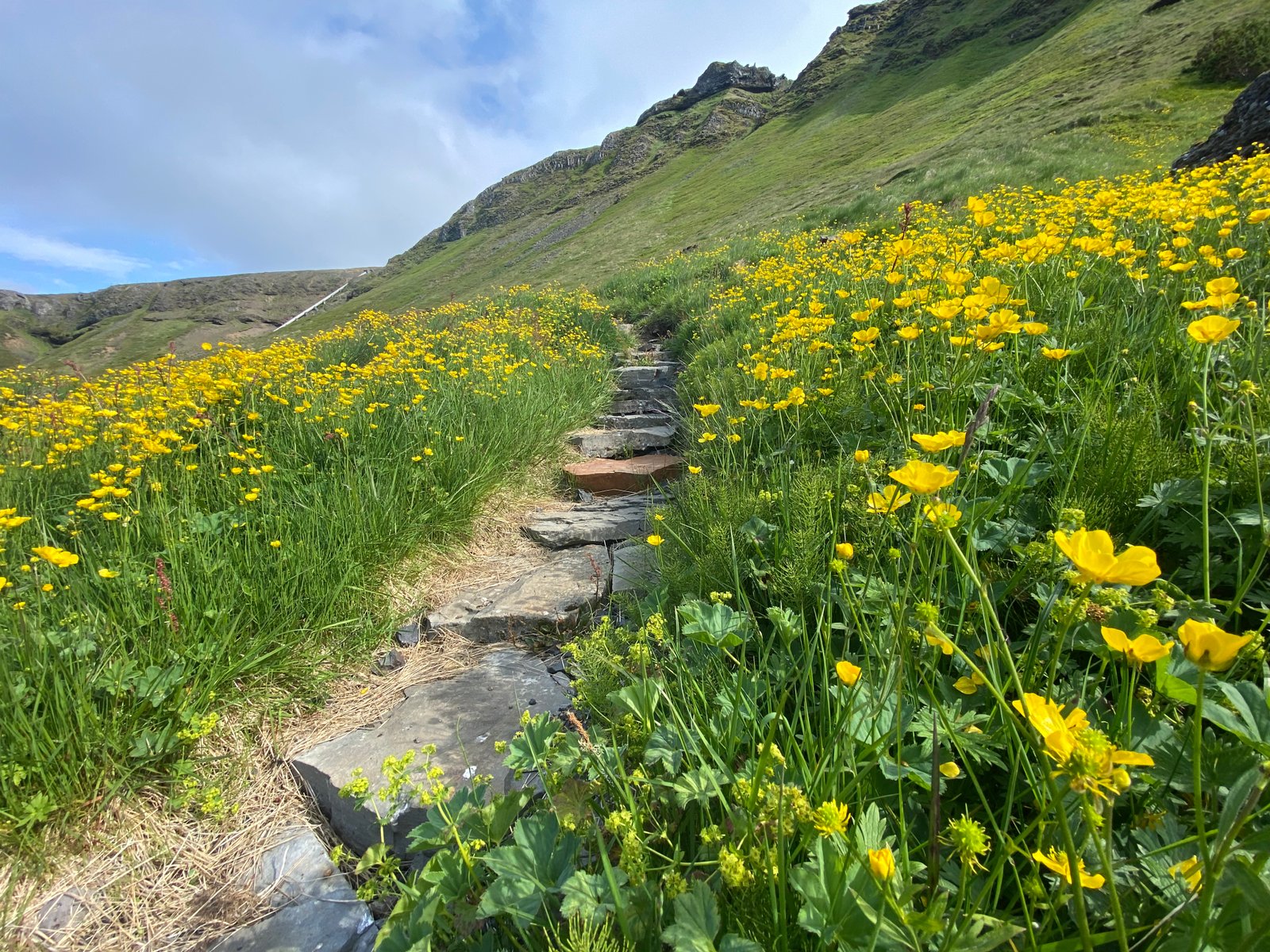
Many routes are clearly marked with stakes for safety, and hikers are strongly encouraged to follow designated paths, GPS guidance, and trail markers.With extended daylight and generally milder conditions, summer 2026 is an ideal time to explore. Here are some of the top hiking trails worth adding to your itinerary:
Síldarmannagötur
Síldarmannagötur is an old national route that is in a protected area in the settlement in Skorradals valley, which is part of maintaining the paths of the past. The hike can be start at Vatnshorn in Skorradalur valley or deep inside the Hvalfjörður bay.
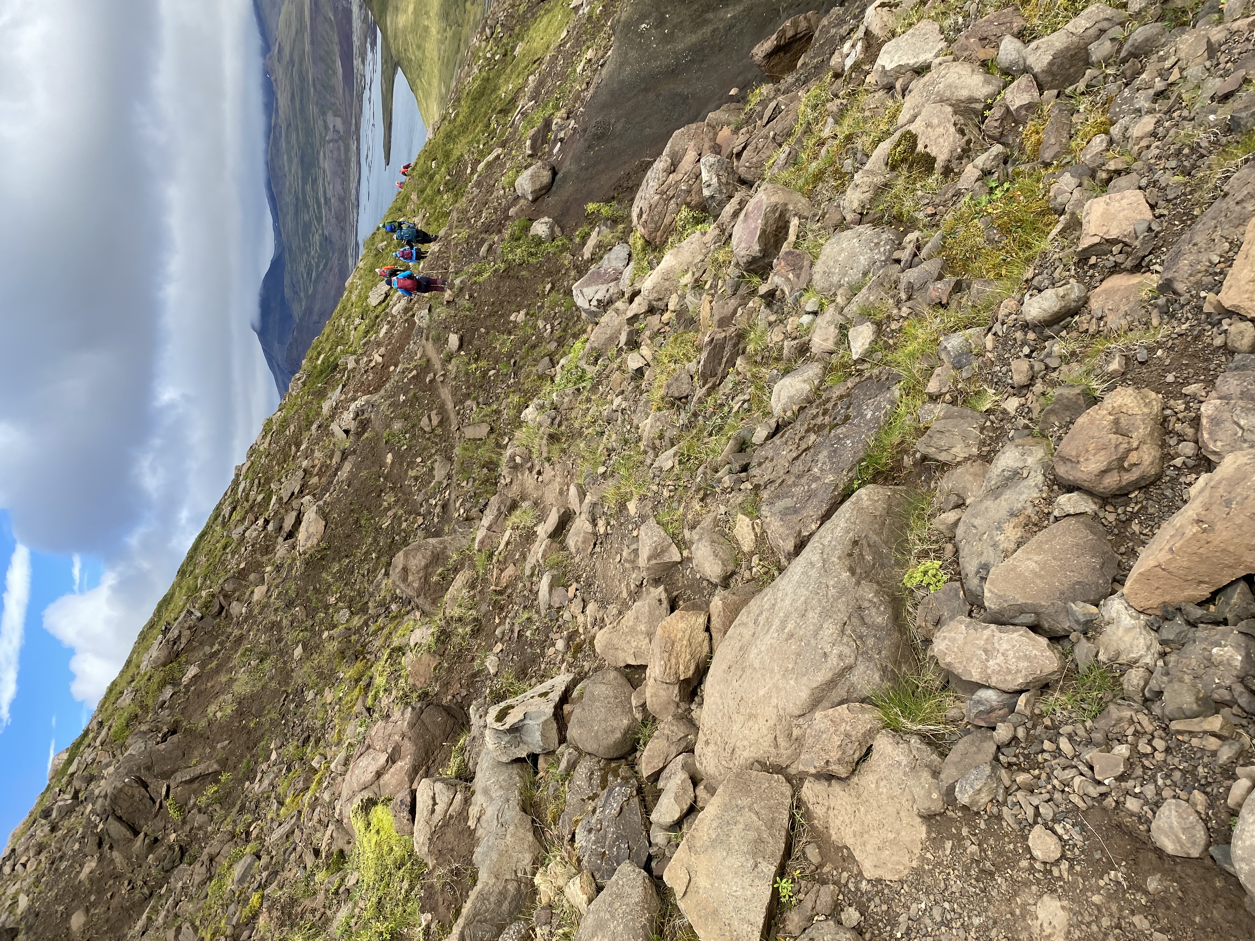
Síldarmannagötur, a hiking trail that connects Skorradalur valley and Hvalfjörður bay, is a popular outdoor route, that can be enjoyed by a wide range of groups. Markings can be found at the beginning and end of the route but volunteers have been diligent in maintaining signs along the way to help hikers along the way. Hikers need to cross Bláskeggsá river
twice on the way, and the trail´s surface varies, from small/big rocks to dirt trails. The views on the trail is magnificent but hikers can enjoy the views from Hvalfjörður bay, Skorradalur valley, glaciers and the magestic Botnssúlur.
Síldarmannagötur have been and will be one of the most popluar outdoor hiking trail in the west, and it is important to maintain it and distribute information about the trail.
Akranes walking trails
Akranes is most populous urban area in Vesturland, with about 7.688 inhabitants. Numerous walking trails can be found, with varied terrain and interesting resting places.
Walking trails can be found on the outskirts of the town, by the sea and into the town itself, allowing visitors and residents of Akranes to experience great diversity.
Akranes has a lot to offer when it comes to leisure and experience, but the best-known areas are Langisandur beach and Breiðin lighthouse area. Langisandur beach is extremely popular among residents of Akranes, but there are numerous recreational opportunities, whether it´s going to Guðlaug natural pool, sea swimming, exercising or enjoying the coastline and the beauty it holds. Breiðin is a popular destination for tourists, with good infrastructure and good information center. Akranes has done great things regarding accessiblilty and information around the walking trail and is a hugely interesting destination to visit.
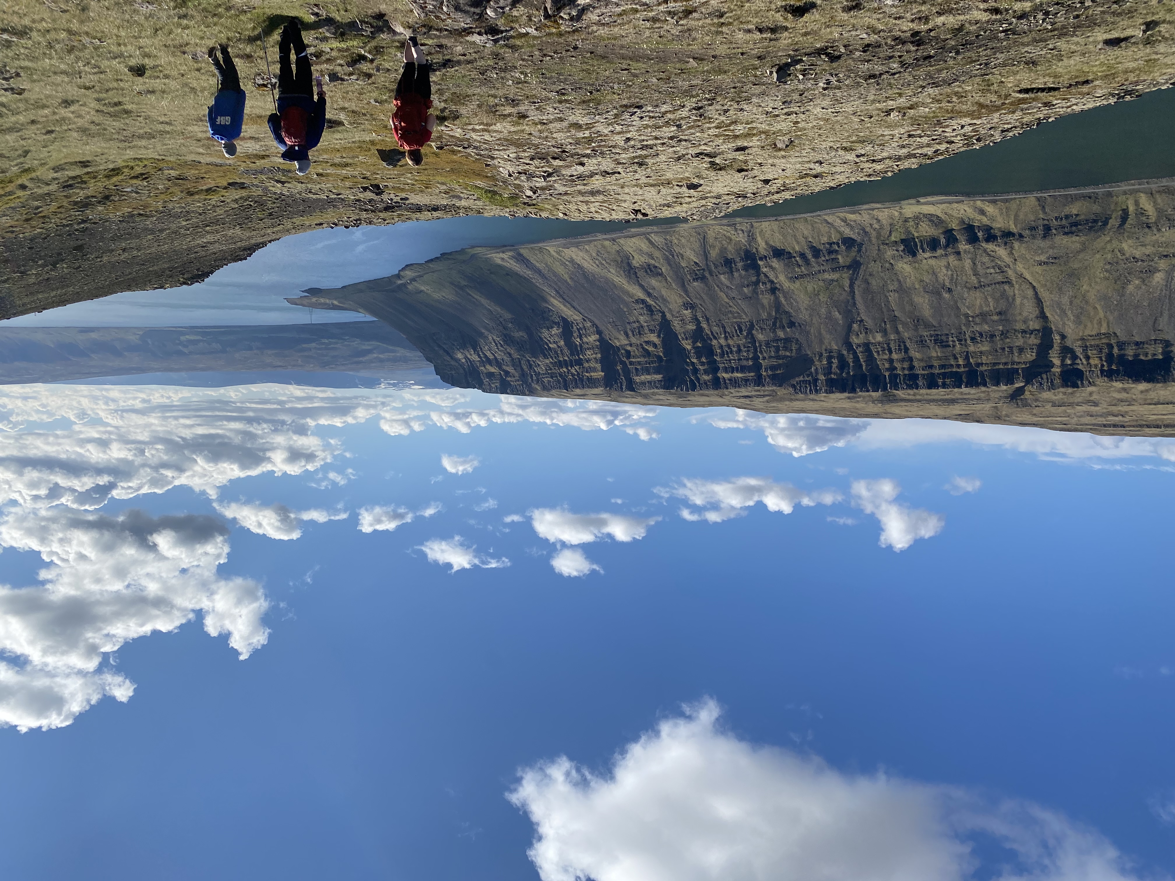
Mt. Drápuhlíðarfjall
Drápuhlíðarfjall is probably among the most beautiful mountains in Iceland. It is 527 meters high, a 3.5 million years old remnant of an extinct volcano. The red and yellow colors characterising the mountain are the hallmark of rhyolite, a silica-rich extrusive (eruption on surface) rock which is the major component of the mountain. The colour is caused by the high contents of silica (SiO2) and consequently the abundance of bright minerals making up the rock. Parts of the mountain are intrusive rocks lower in silica - basaltic and intermediate in composition.
Á á Skarðsströnd to Vogur Fellströnd
Breiðafjörður has been known as the "Foodchest of Iceland" throughout the centuries and there are numerous islands in the fjord. During summer the traffic in the area increases. Excursions through the islands are available. At Skarðsströnd there is a campsite and a service center. Vogur has a magnificent coutry hotel.
It is possible to start hiking at Á in Skarðsströnd or at Vogur in Fellsströnd. The hike is towards Klofningur, from which there is a spectacular view of Breiðafjörður and Hvammsfjörður.
Brynjudalsskógur forestry
In Brynjudalur you will find great tranquility and proximity to an immensely beautiful mountain range, where Botnssúlur mountain range loom over the area. The area is busy during the Christmas season, where Christmas tree sales take place there every year. The forest itself is well-kept and is very neat. A hiking trail through Brynjudalsskógur offers guests tranquility and beautiful surroundings. The mountainous terrain around the forestry gives a great impression on the environment and the forestry is a quiet place to enjoy and experience. The area has different hiking trails as well as numerous resting stops. Hiking paths can be found in the forest and some of them are used as starting or ending routes for traditional hiking trails on Leggbrjót over to Þingvellir or up to Botnsúlum.

Vatnaleið hiking trail
Vatnaleið walking trail, lies past four lakes: Hlíðarvatn lake, Hítarvatn lake, Langavatn lake and Hreðavatn lake. It's a beautiful walking trail that lies through varied landscape, mountains and fields and the view is magnificent over Hnappadalur Valley, Borgarfjörður region and the surrounding area.
The route has been marked and it's possible to stay over night at the mountain cabins on the route.
Ólafsvík walking trail
A hiking trail around Ólafsvík borders and into the town's heart is enjoyable and diverse. Service area is located at the campsite and a lot of resting places along the trail. Information signs are plentyful on the trail along side playground equipment for all ages. The trail is suitable for everyone who wants to enjoy.
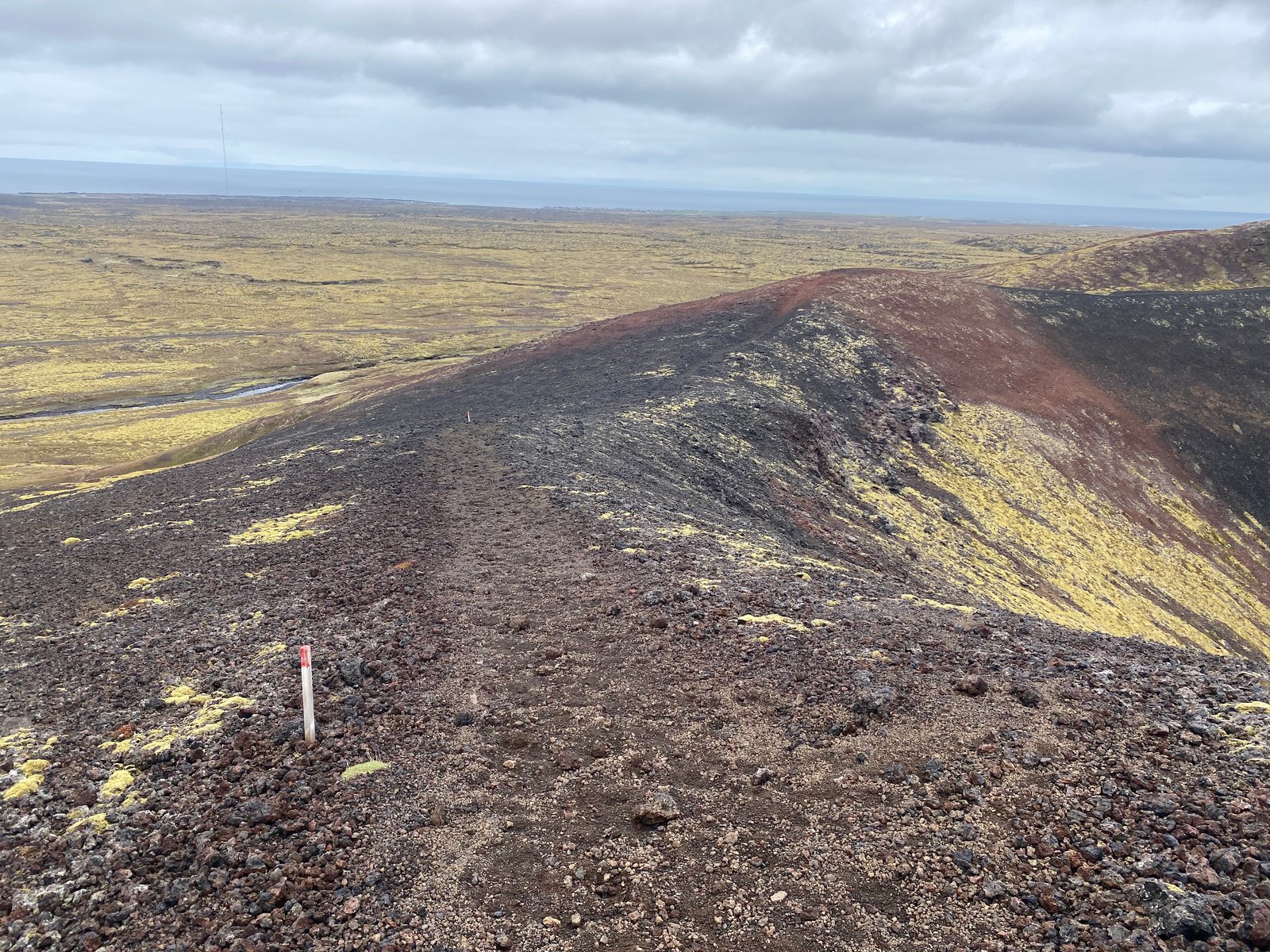
Rauðhóll hiking trail
From the crater Rauðhóll, lava flowed into the sea, all the way from Hellisandi to Skarðsvík. A marked path leads from the parking lot at Eysteinsdalsvegur to Rauðhóll, with the hiking trail going over an old lava field along with grass and small rocks, next to beautiful ponds that have formed around the area.