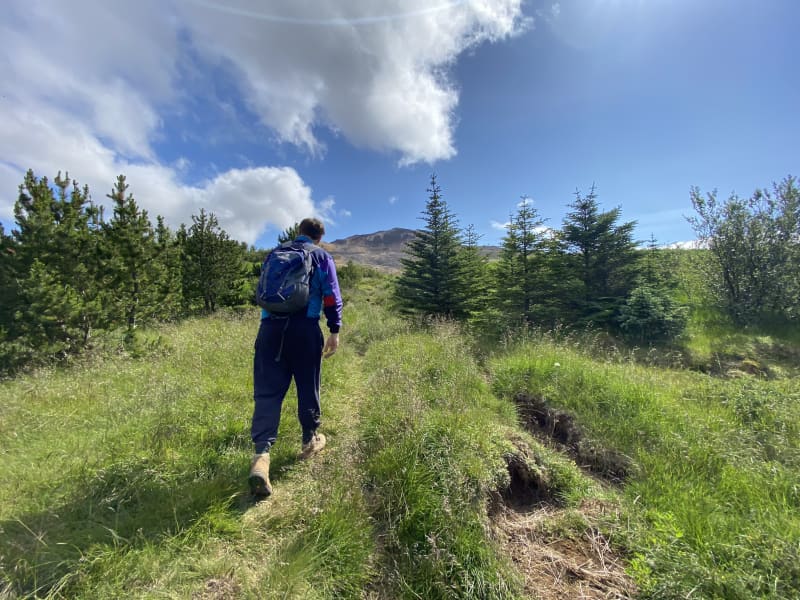
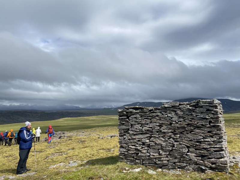
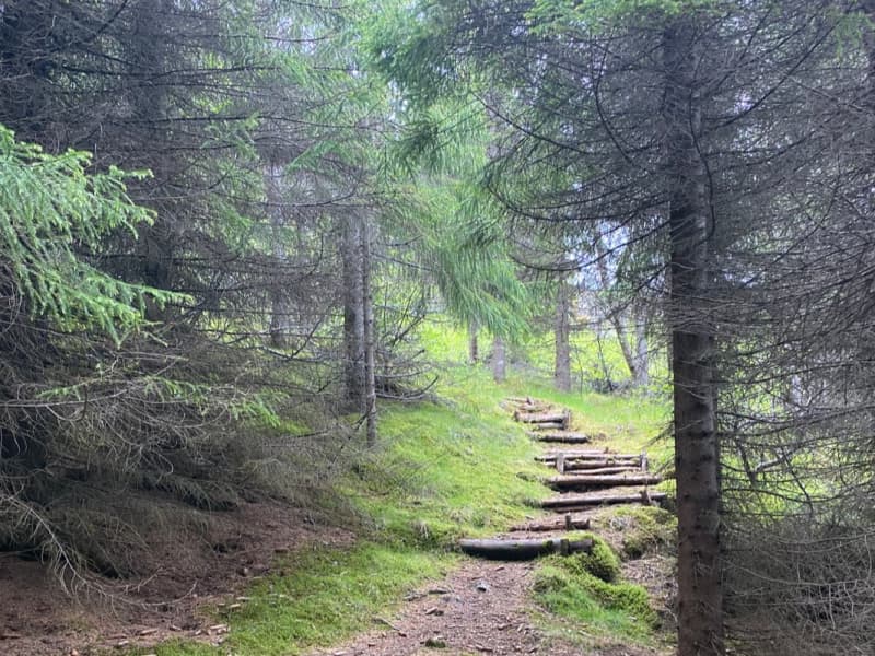
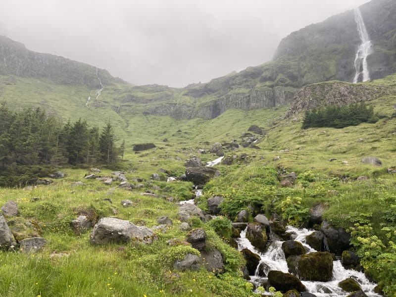
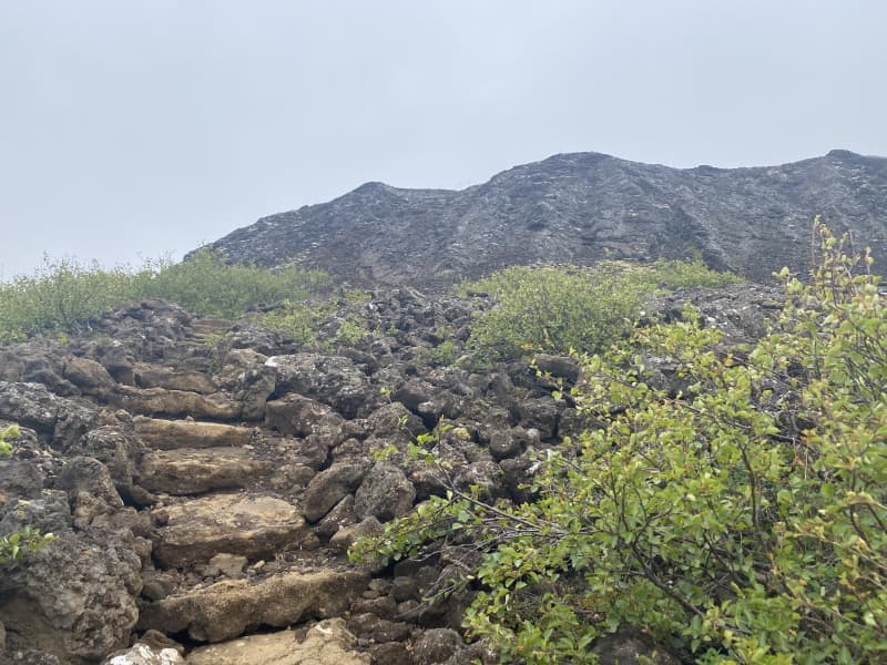
Walking trails of all kinds and difficulties can be found in West Iceland. Short walks, long hikes, on flat land, mountain peaks and everything in between. A lot of trails in the region have been marked with stakes for safety reasons and we strongly advise hikers to follow paths, gps coordinates and markings.
Everyone should be able to find a suitable trail.
See the difficulty scale below:
|
Easy Good paths and trails that everyone should be able to walk. Easy and short hiking trails, suitable for wide group of hikers. Trails are accessible for wheelchairs and strollers. Trails without any obstacle or difficulty. |
Moderate Simple amusement trails that can be used by a wide range of users. Suitable for families and groups. Less than 100 meters of elevation gain on the trails. |
Challenging Trails and paths that are for experienced hikers, where there is possibly not a path or a trail all the way. Walking on a rough and difficult section and there are several obstacles such as unbridged streams, high elevations, loose gravel and smaller rivers. It is important to pay close attention to the weather in the specific area and general conditions. |
Difficult Trails and paths that are only for very experienced hikers with proper equipment. Very difficult routes, where you can find larger unbridged rivers, steep and rocky terrain, which can be dangerous if hikers are not used to such landscape and routes can also be in bad conditions. It is important to register a travel plan on safetravel.is and pay close attention to the weather.safetravel.is |
Basic safety information before hiking:
Monitor the weather and be prepared for the fact that here in Iceland the weather can change in little or no time. It is also important to review the equipment that will be brought and check the conditions before setting off. Equipment such as warm clothes, good walking shoes, mittens and a hat along with all basic protective clothing is important along with having a GPS device. Additional equipment is then placed in a backpack, with lunch, water, additional clothing and a first aid kit. Before setting off, it is very important to visit the website of the Icelandic weather office vedur.is, but if the weather forecast is bad and the wind speed is predicted to be over 18 meters per second, it is right to postpone the trip or change the date. It is also important to visit the Safe Travel website safetravel.is and make sure that your trip has good travel preparation
It is important to prepare well for hiking, especially in autumn and winter. When hiking in the mountains during the winter, it is also important not to be alone when hiking and let people know about your trips. It is extremely important to prepare well and carefully for each trip, but the main risks in winter tourism are:
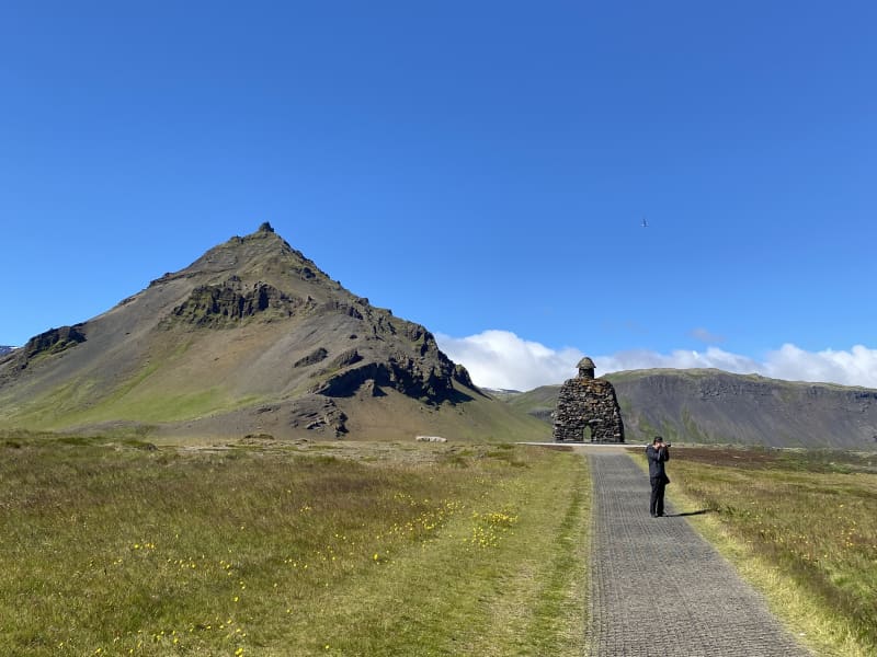
Akranes walking trails
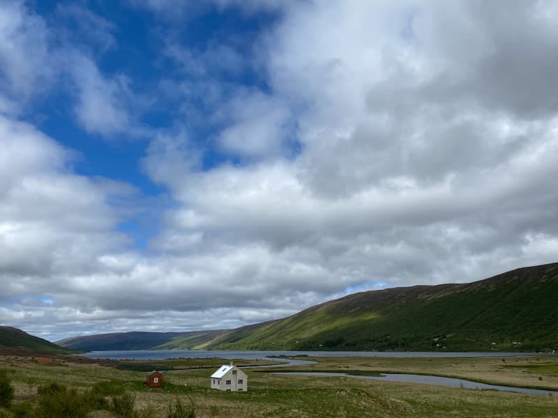
Akranes is most populous urban area in Vesturland, with about 7.688 inhabitants. Numerous walking trails can be found,with varied terrain and interesting resting places. Walking trails can be found on the outskirts of the town, by the sea and into the town itself, allowing visitors and residents of Akranes to experience great diversity.
Akranes has a lot to offer when it comes to leisure and experience, but the best-known areas are Langisandur beach and Breiðin lighthouse area. Langisandur beach is extremely popular among residents of Akranes, but there are numerous recreational opportunities, whether it´s going to Guðlaug natural pool, sea swimming, exercising or enjoying the coastline and the beauty it holds. Breiðin is a popular destination for tourists, with good infrastructure and good information center. Akranes has done great things regarding accessiblilty and information around the walking trail and is a hugely interesting destination to visit.
Area: Akranes
Road number to the starting point: Kalmansbraut (nr. 51), at the campsite of Akranes.
Level of difficulty: Easy
Length: 10.36 km
Elevation: 0-50 meters
Markings: No markings.
Duration: 2.15 hours
Route type: Paved paths and small rocks.
Obstacles on the way: No obstacles.
Service in the area: At the campsite and different service companies in the area.
Illumination: The majority of the path is lit, but a part that is unlit.
Season: The walking trail is open all year round.
GPS coordinates to the starting point: N64°19.5756 W022°04.0371 at the campsite of Akranes.
GPS coordinates to the ending point: N64°18.7945 W022°02.6144 at the monument „Heaven“.
View
Garðalundur Akranes forestry
At Akranes, you can find three fun hiking trails through forestries. One is in Garðalund, one in Klapparholt and one inSlaga. Garðalundur has a variety of recreational opportunities for the residents and visitors of Akranes, Klapparholt is a forest where you can find many different types of vegetation, such as birch and pine and at Slagi forest,which is located at the roots of Akrafjall mountain, where visitors can find different walking trails, along with different plant life and fantastic views over Akranes and Faxaflói bay.
In Garðalund you can find a variety of recreation for residents and visitors of Akranes. Volleyball court, frisbeegolf course, exercise equipment, resting places, cabin, walking trails and information boards. A flourishing social area, with infrastructure like toilets and garbage bins, where visitors can enjoy the many recreational options thatcan be found in Garðalundur.
Entering Klapparholt, you can find several information sign about the area and the couple Guðmundur Guðjónsson andRagnhildur Árnadóttir, who started cultivation and organization in the area in 1988. You can also find „Klapparholtið“, but it is in the middle of the forestry. There are stories that an elf church and hidden people live in the „Klapparholtchurch“ that stands there. It is popular for outdoor enthusiasts to use the area for walking, running or cycling.
In Slaga forestry you can find resting places and infrastructure like toilets and garbage bins, but is addition there is agreat view of Akranes and the surrounding area. There is a trail from Slaga to the starting path up Akrafjall, but it is also popular for outdoor enthusiasts to use the area for walking, running or cycling.
Area: Akranes
Road number to the starting point: At Garðalund (Klapparholtsvegur) inside Akranes.
Difficulty level: Easy. Accessibility for wheelchairs and wagons but on some trails, the accessibility is not available.
Length: 12.31 km
Elevation: 50-100 meters.
Markings: There can be found marking in some of the areas but not in-between the areas. The paths are very visible.
Duration: 2.23 hours.
Route type: Small rocks, grass and mixed material.
Obstacles on the way: No obstacles inside Garðalundur and Klapparholt but there are steps and difficult grass paths in Slaga.
Services in the area: At Garðalund and at Slaga.
Illumination: Some illumination between the forestries.
Season: The walking trail is open all year round.
GPS coordinates to the starting point: N64°19.3052 W022°02.2243. At Garðalund.
GPS coordinates to the finishing point: N64°19.9648 W021°58.8807. At Slaga.
View
Álfholtsskógur foresty
An outdoor area into Álfholtsskógur forest is a popular destination for travelers in Hvalfjarðarsveit but the accessibility has been improved over the las few years and is defined as an "Open forrest". There are markings along the trails and resting stops. The beginnings of forestry in Álfholtsskógur can be traced back to 1939, and today more than 130 species of trees and flora can be found in the forest.
Hiking trails around Álfholtsskógur are diverse and challenging, but the facilities to enjoy are first class. Resting stops to eat a picnic or only simply enjoy the area, are available and there are markings on the trails. Members of the Skilmannahreppur Forestry Association have worked on marking the routes and improving access for hikers, with the construction of bridges and different steps up the slopes of Álfholtsskógur.
Area: Hvalfjörður.
Road number to the starting point: Akrafjallsvegur (nr. 51).
Level of difficulty: Easy.
Length: 7 km/ 4,34 miles.
Elevation: 0-50 meters /164 ft elevation.
Markings: The route is marked with signs pointing out the way.
Duration: 1 hour and 30 minutes.
Route type: Small rocks, wood chips, grass and mixed substrate.
Obstacles on the way: Steps and bridges on the way.
Services in the area: There are trash bins in the parking area.
Illumination: No illumination.
Season: This hiking trail is open all year round.
GPS coordinates to the starting point: N 64°22.2406 W 021°51.0028.
GPS coordinates to the finishing point: N 64°22.2406 W 021°51.0028.
View
Fossá forestry
The Fossá forestry is located next to the highway nr. 47 and the rest stop at the outskirts of forestry has a great attraction of tourists around the area, but the view from there is excellent. The old structure used for sheep round- up and the waterfall, Sjávarfoss, attract a lot of attention when driving around the area as well as Hvalfjörður’s view.
Fossá is a forestry area in Hvalfjörður that is managed by four forestry associations. Mosfellsbær Forestry Association, Kjalarnes, Kjós and Kópavogur. Fossá was officially incorporated into the Open Forest project in 2011. The Fossá area has a sheltered area and a lot of forest, but also has to offer mussel beaches off Fossárós, waterfalls and rapids that travel along the Fossá river and excellent berry land. The land totals 1,100 hectares and over a million plantings have been planted being spruce, birch and pine mainly planted. At Fossá you will find marked hiking trails as well as resting stops, and the area has great outdoor opportunities. The four forestry associations, established in 2001, a forestry management company over the land, and developments in the area where implemented such as path and roads and construction in the forest. This management company is called Fossá Forestry Company, which has its income from the sale of Christmas trees, but in recent years the sale of forest wood for various uses has also occurred. Christmas tree cultivation is important in the area and the management company has a good income from sales each year.
Area: Kjósahreppur.
Road number to the starting point: Hvalfjarðarvegur (nr. 47).
Level of difficulty: Easy way. There is accessibility for strollers and wheelchairs in many places, but not everywhere.
Length: 9.5km/ 5.71 miles.
Elevation: 50-100 meters/ 164- 328 ft elevation.
Markings: Signs are visible on parts of the trail, but in some places there are no markings.
Duration: 2 hours.
Route type: Small and big rocks, grass.
Obstacles on the way: Steps and wades.
Services in the area: No services.
Illumination: No illumination.
Season: The hiking trail is open all year round.
GPS coordinates to the starting point: N 64°21.1996 W 021°27.9139
GPS coordinates to the finishing point: N 64°21.1996 W 021°27.9139
View

Brynjudalsskógur forestry
Since 1990, the Icelandic Forestry Association has engaged in Christmas tree cultivation in Brynjudalur in Hvalfjörður, an indispensable part of Christmas celebrations tradition. In Brynjudalsskógur, wood has been used for the construction of shelters and paths. There are two shelters in the forest, several resting places and a puzzle track. There are numerous walking paths in the forrest along with paths that can be used as a starting or finishing point for hiker going the traditional hike over Leggjabrjótur, over to Þingvellir or up to Botnsúlur.
Into Brynjudalur you will find great tranquility and proximity to an immensely beautiful mountain range, where Botnssúlur mountain range loom over the area. The area is busy during the Christmas season, where Christmas tree sales take place there every year. The forest itself is well-kept and is very neat. A hiking trail through Brynjudalsskógur offers guests tranquility and beautiful surroundings. The mountainous terrain around the forestry gives a great impression on the environment and the forestry is a quiet place to enjoy and experience. The area has different hiking trails as well as numerous resting stops. Hiking paths can be found in the forest and some of them are used as starting or ending routes for traditional hiking trails on Leggbrjót over to Þingvellir or up to Botnsúlum.
Area: Kjósahreppur.
Road number to the starting point: Hvalfjarðarvegur (nr. 47). Drive into Ingunnarstaðaveg.
Difficulty level: Easy
Length: 3.2km/ 1.98 miles
Elevation: 103 meters/ 337.92 ft elevation.
Markings: Some parts of the hiking trail are marked.
Duration: 1 hour.
Route type: Some rocks and grass.
Obstacles on the way: Steps on the way.
Services in the area: No services in the area.
Illumination: No illumination.
Season: The hiking trail is open all year round.
GPS coordinates to the starting point: N 64°21.8068 W 021°18.1513
GPS coordinates to the finishing point: N 64°21.8068 W 021°18.1513
View
Síldarmannagötur
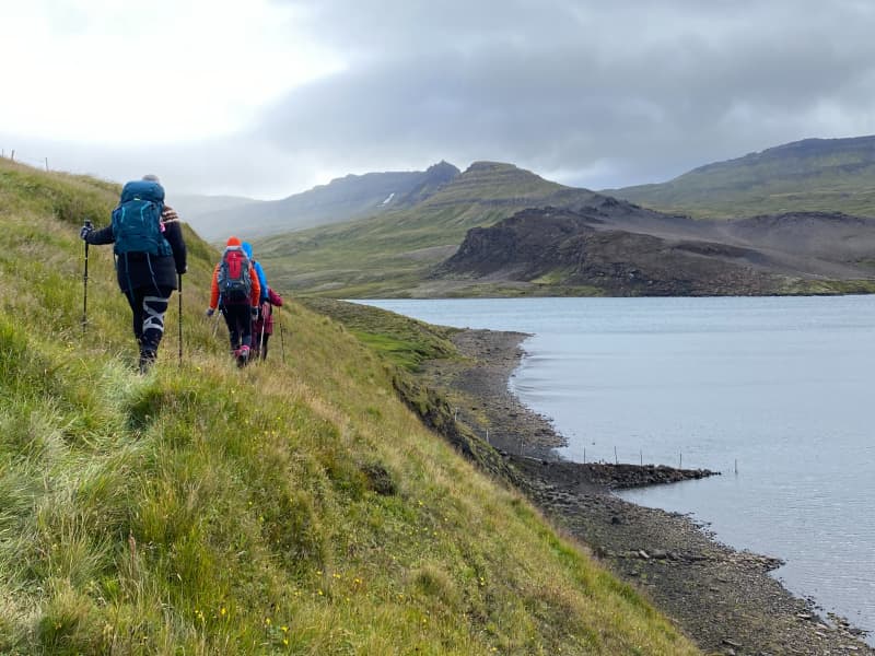
Síldarmannagötur is an old national route that is in a protected area in the settlement in Skorradals valley, which is part of maintaining the paths of the past. The hike can be start at Vatnshorn in Skorradalur valley or deep inside the Hvalfjörður bay.
Síldarmannagötur, a hiking trail that connects Skorradalur valley and Hvalfjörður bay, is a popular outdoor route, that can be enjoyed by a wide range of groups. Markings can be found at the beginning and end of the route but volunteers have been diligent in maintaining signs along the way to help hikers along the way. Hikers need to cross Bláskeggsá rivertwice on the way, and the trail´s surface varies, from small/big rocks to dirt trails. The views on the trail is magnificent but hikers can enjoy the views from Hvalfjörður bay, Skorradalur valley, glaciers and the magestic Botnssúlur.Síldarmannagötur have been and will be one of the most popluar outdoor hiking trail in the west, and it is important to maintain it and distribute information about the trail.
Area: Hvalfjörður bay /Skorradalur valley
Road number to the starting point: Hvalfjarðarvegur (nr. 47) and road in Skorradalur (nr. 508)
Difficulty level: Hard/Challenging
Length: 15.56 km
Elevation: 500 meters.
Markings: Stiks and rock markings.
Duration: 4 hours.
Route type: Small and large rocks, grass, wetlands and meadows.
Obstacles on the way: Bláskeggsá river but hikers need to cross it twice.
Service in the area: No service.
Illumination: No illumination.
Season: The route is closed from november until may, due to weather and conditions on the route.
GPS coordinates to the starting point: N64°28.4501 W021°19.1845. At Vatnshorn in Skorradlur valley.
GPS coordinates to the finishing point: N64°23.2899 W021°21.5792. In Hvalfjörður bay.
View
Eiriksstadir walking route
At Eiríksstaðir in Dalir there are ancient ruins which are probably the farm of Eirík the Red Þorvaldsson and his wife Þjóðhildur Jörundardóttir. The ruins of the farm are protected ancient monuments.
A little west of the ruins at Eiríksstaðir, a replica farmhouse was built, which was inaugurated in 2000 on the occasion of the 1000th anniversary of Leif's successful landing in America.
At Eiríksstaðir there is a living museum. The staff is dressed according to the traditions of the 10th century and educate visitors about life a thousand years ago, old work culture and farming practices. You can also view crafts, weapons and various items from the period. There are also historical information signs in the area and a statue of Leif Eiríksson by Nína Sæmundsson.
Road no. 60 (Vestfjarðarvegur). Turn right onto road no. 586 (Haukadalsvegur) and drive to the parking lot at Eiríksstaðir. There is a good parking lot and a service cabin, along with toilets and information boards. Trails lead to the replica turf house but also to monuments in the area. The trail is partly with small gravel and partly with pavement rocks.
Area: Dalabyggð
Road number to the starting point: Road number. 586 (Haukadalsvegur)
Level of difficulty: Easy/moderate
Length: 0.6 km.
Elevation: 29 m.
Markings: No markings but the route is visible, except in the case of heavy snow
Duration: 13 minutes
Route type: Small-paved and flat rocks
Obstacles on the way: No obstacles
Service: Toilets, garbage bins and the possibility to buy a guided tour in the replica house during opening hours
Illumination: No illumination
Season: Hiking trail is open all year round, but can be unpassable during heavy snow
GPS coordinates to starting- and finishing point: N 65°03.5023 W 021°32.1731
View
Á Skarðsströnd to Vogur Fellsströnd
Breiðafjörður has been known as the "Foodchest of Iceland" throughout the centuries and there are numerous islands in the fjord. During summer the traffic in the area increases. Excursions through the islands are available. At Skarðsströnd there is a campsite and a service center. Vogur has a magnificent coutry hotel.
It is possible to start hiking at Á in Skarðsströnd or at Vogur in Fellsströnd. The hike is towards Klofningur, from which there is a spectacular view of Breiðafjörður and Hvammsfjörður.
On the hiking trail itself, there are several beautiful lakes and pleasant nature. At Vogur in Fellsströnd, you will find country hotel and at Á in Skarðsströnd you will find a campsite as well as a service center. No markings can be found along the trail, and there are some parts that can be hard to distinguish. Should be noted that there is a river on the trail that needs to be crossed.
Area: Skarðsströnd/Fellsströnd, Dalabyggð
Road number to the starting point: Klofningsvegur (nr. 590)
Difficulty level: Challenging
Length: 22.50 km / 13.98 miles
Elevation: 889 meters / 2916,66 ft elevation
Markings: No markings along the route
Duration: 7 hours
Route type: Small and large rocks, soil and grass substrates, meadows and wetlands
Obstacles on the way: A step or ledge to climb and an unbridged stream
Dangers on the way: Rock collapse, wading and wind
Services in the area: There are services at Á in Skarðsströnd and at Vogur in Fellsströnd
Illumination: No illumination
Season: The route is open except during winter time due to weather conditions
GPS coordinates to the starting point: At Krossá: N65°15.7793 W022°20.7537
GPS coordinates to the finishing point: At Vogur: N65°10.5871 W022°21.9751
View
Búðardalur-Laxarós
Búðardalur is a town with many services available and the main attraction is Vínlandssetrið, which features exhibitions and stories of the landmarks of Eiríkur the Red and Leifur the Lucky Eiríksson. From there, begins a hiking trail to Laxarós. In Vínlandssetrið there’s a tourist information centre. Búðardalur accommodates a guesthouse, a campsite, a restaurant and café.
When driving into Búðardalur road no. 60 (Vestfjarðarvegur), there´s a turn into Miðbraut street. From there, you drive into the Vínlandssetrið and a parking is available. It´s also possible to drive into Brekkuhvamm and end up at Vínlandssetrið. At the beginning of the walk you enter Ægisgata, where there´s a sidewalk that leads up the street. Down by the shore, pedestrian bridges have been installed for easy access and mats have been put down on the trail for easy access for visitors. A hiking trail around Búðardalur-Laxarós is beautiful and varied, with fun resting stops along the way. A hiking trail is very clear when you reach the shoreline, but there is little marking on the whole route. Vínlandssetrið is a very suitable place to start or end a hike, where you can find a variety of services but it would also be possible to start hiking in other places in Búðardalur.
Area: Búðardalur, Dalabyggð.
Road number to the starting point: Vestfjarðarvegur (nr. 60) and intersections Miðbraut and Ægisbraut into Búðardal.
Difficulty level: Easy.
Length: 1.43 km/ 0,88 miles.
Elevation: 0-50 meters/ 164 ft.
Markings: There are many markings along the way.
Duration: 21 minutes.
Route type: Asphalt, small stones, grass, tree curls, mixed surfaces.
Obstacles on the way: There are many steps.
Services in the area: Vínlandssetrið.
Illumination: No illumination.
Season: This hiking trail is open all year.
GPS coordinates to the starting point: N65°06.6323 W021°46.3246
GPS coordinates to the finishing point: N65°05.9515 W021°46.3543
View
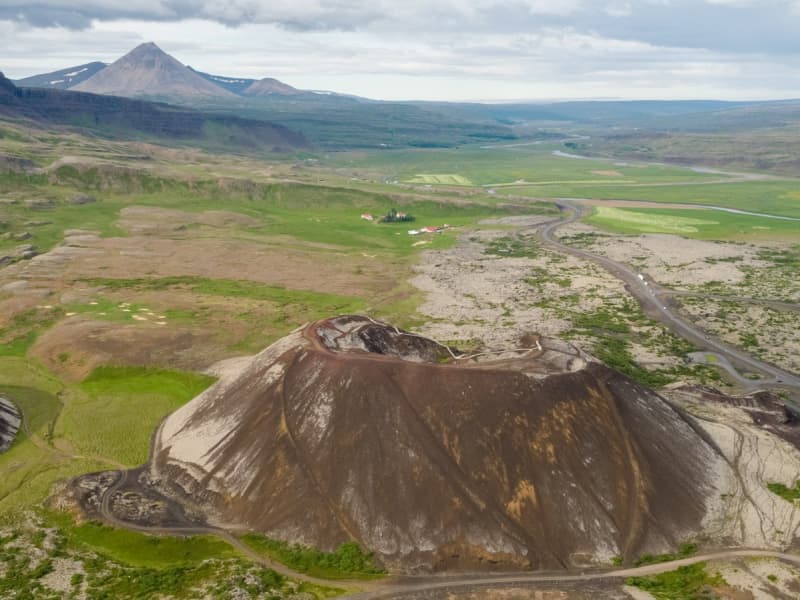
Grabrok Crater
The largest of three craters in a short volcanic fissure.
Beautiful scenery over Borgarfjordur is from the top of the Grabrok crater. Mt. Grabrok can be ascended by a marked trail from the main Ring road no. 1.
View
Mt. Drápuhlíðarfjall
Drápuhlíðarfjall is probably among the most beautiful mountains in Iceland. It is 527 meters high, a 3.5 million years old remnant of an extinct volcano. The red and yellow colors characterising the mountain are the hallmark of rhyolite, a silica-rich extrusive (eruption on surface) rock which is the major component of the mountain. The colour is caused by the high contents of silica (SiO2) and consequently the abundance of bright minerals making up the rock. Parts of the mountain are intrusive rocks lower in silica - basaltic and intermediate in composition.
In the past it was a common belief that gold occured in the mountain. Gold has not been found in usable quantities despite considerable search. Fool's gold, however, i.e., iron pyrite (FeS2) glowing as gold, is commonly found in the mountain.
A striking feature of Drápuhlíðarfjall is a large rockslide which fell from the north-western side of the mountain, probably shortly after the end of las ice age. The slide is around one kilometer long and up to 100 meters thick, where it is thickest. Rhyolite tends to cleave easily into thin plates, and such plates from the rockslide were popular as decorative coating on walls and fireplaces around the middle of last century. Numerous homes in Iceland are accordingly decorated by rocks from Mt. Drápuhlíðarfjall. Today, sampling rock here is strictly forbidden.
The farm Drápuhlíð is refered to in the famous Eyrbyggja Saga, written sometime after the year 1250, happening mostly on the north side of the Snæfellsnes peninsula roughly within the timeframe of around 963 to around 1031 AD. In Drápuhlíð lived Vigfús Björnsson, who was a good farmer, but a difficult man to get on with. Vigfús offered his slave, Svartur the strong, to give him his freedom if he would go over to Helgafell and kill Snorri the Priest. This attempt on Snorri's life failed and Vigfús had to pay for his attempt with his own life.
Until the midst of last century, three small farms were located at the base of Mt. Drápuhlíðarfjall, i.e. Efrihlíð, Innri Drápuhlíð and Ytri Drápuhlíð. Numerous ruins of farmhouses and sheepcots are still visible to the southwest of this point.
Area: Snæfellsnes
Road number to the starting point: Road number 54 (Snæfellsnesvegur)
Level of difficulty: Challenging.
Length: 5.6 km.
Elevation: 527 meters
Markings: Markings on the trail
Duration: 1.5 hours
Route type: Small rocks, mixed materials and grass
Obstacles on the way: There are steps on the trail
Service: No service in the area
Illumination: No illumination
Season: Hiking trail is open the whole year round except during winter due to weather conditions
GPS coordinates to starting- and finishing point: N 64°59.7110 W 022°44.4627
View
Vatnaleið Hiking Trail
Vatnaleið walking trail, lies past four lakes: Hlíðarvatn lake, Hítarvatn lake, Langavatn lake and Hreðavatn lake. It's a beautiful walking trail that lies through varied landscape, mountains and fields and the view is magnificent over Hnappadalur Valley, Borgarfjörður region and the surrounding area.
The route has been marked and it's possible to stay over night at the mountain cabins on the route.
First Leg - Hlíðarvatn lake - Hítarvatn lake
Road number to the starting point: Road number 55 (Heydalsvegur)
Level of difficulty: Challenging
Length: 12.29 km.
Elevation: 657 m.
Markings: Markings on the trail
Duration: 3.36 hours
Route type: Small rocks, mixed materials, wetlands and grass
Obstacles on the way: There are steps on the trail
Service: Toilets, garbage disposal, campsite and guided tours available
Illumination: No illumination
Season: Hiking trail is open exept during winter due to weather conditions
GPS coordinates to starting point: N 64°54.1901 W 022°08.998 (at Hlíðarvatn lake)
GPS coordinates to finishing point: N 64°51.9973 W 022°01.0635 (at Hítarvatn lake)
Second Leg - Hítarvatn lake - Langavatn lake
Road number to the starting point: Road number 538 (Hítardalsvegur)
Level of difficulty: Challenging
Length: 21.24 km.
Elevation: 666 m.
Markings: Markings on the trail
Duration: 5.30 hours
Route type: Small rocks, mixed materials, wetlands and grass
Obstacles on the way: There are steps on the trail
Service: Toilets, garbage disposal, campsite and guided tours available
Illumination: No illumination
Season: Hiking trail is open except during winter due to weather conditions
GPS coordinates to starting point: N 64°51.9973 W 022°01.0635 (at Hítarvatn lake)
GPS coordinates to finishing point: N 64°46.9421 W 021°45.5057 (at Langavatn lake)
Third Leg - Langavatn lake - Hreðavatn lake
Road number to the starting point: Road number 553 (Langavatnsvegur)
Level of difficulty: Challenging
Length: 13.54 km.
Elevation: 574 m.
Markings: Markings on the trail
Duration: 4.06 hours
Route type: Small rocks, mixed materials, wetlands and grass
Obstacles on the way: There are steps on the trail
Service: Toilets, garbage disposal, campsite and guided tours available
Illumination: No illumination
Season: Hiking trail is open except during winter due to weather conditions
GPS coordinates to starting point: N 64°46.9421 W 021°45.5057 (at Langavatn lake)
GPS coordinates to finishing point: N 64°45.3059 W 021°35.7743 (at Hreðavatn lake)
View
England/Peter's fortress trail
The walk is a circular ring that connects Basalt Hotel at Iðunnarstaðir. Going up the ridge, passing through Hrútaborgir and Pétursvirki (Peter's fortress), going down the ridge in direction to England's Pool, crossing Tunguá river and going along the main road to Krosslaug and following the river back to Iðunnarstaðir.
The trail is mixed with a variety of footpaths, various resting stops and a view of the mountain ranges of Lundareykjadalur in Borgarfjörður. Pétursvirki (Peter's Fortress) is a manmade structure that stands on the Engaland's ridge and has been re-constructed. England's Pool is inside Lundareykjadalur, but it's surroundings is overgrown with grass. The pool is partly formed, man-made, while in other places there are rocks or grass on its banks. Krosslaug in Lundareykjadalur is a protected pool and it is believed that Westerners used to be baptized in Krosslaug after Christianity was legalized in Iceland in the year 1000.
Area: Lundarreykjadalur, Borgarbyggð
Road number to the starting point: Uxahryggjavegur (nr. 52), at Iðunnarstaðir
Level of difficulty: Challenging
Length: 12 km/7.4 miles
Elevation: 424 meters /1391 ft.
Markings: Sticks on the way
Duration: 3 hours and 35 min.
Route type: Small and large stones, soil and grass substrates
Obstacles on the way: There are steps on the way, but its also necessary to wade across the Tunguá River or cling a red iron fence that crosses the river
Services in the area: There are services available at Basalt Hotel
Illumination: No illumination on the hiking trail
Season: This hiking trail is open all year round
GPS coordinates starting- and finish point: N64°29.9538 W021°14.9126
View

Húsafell hiking trails
Húsafell offers diverse and fascinating hiking trails where dense forests, spectacular ravines, waterfalls, glaciers, fauna and bird life as well as cultural markings making the area so attractive. A map with different hiking trails accessible in the area is available at Hotel Húsafell's building and website.
Húsafell is one of the most popular holday places in Iceland, but recently became defined as a residential area too. There are numerous activities around the area that will suit everyone's preferences whether it is hikings, glacier tours or cave exploring, golf. dip in geothermal water and even wild life /animal life observation (different bird and foxes). The beginning of hiking trail is at Hotel Húsafell and there is a large information sign below the hotel. The routes are: Bæjargil, Oddaleið, Kiðárbotnar, Háifoss, Hraunfossar and Kaldárbotnar.
About each route:
Húsafell-Bæjargil - The hiking trail is a beautiful route where outdoor enthusiasts can enjoy the history of the area, tranquility and views. The hiking trail is clearly visible, marked in sections and is a busy route for visitors to Húsafell.
The Húsafell-Oddaleið hiking trail is a beautiful route where watery rivers make their mark on the hiking trail. The route is well clear, marked and a busy route by the visitors of Húsafell.
The hiking trail of Húsafell - Kaldárbotnar holds magnificent views of Langjökull glacier and Strútur, while the river Geitá lies close to the route. You walk along the main road, into Kaldadalsvegur, walk into Húsafellsskógur and back.
The Húsafell-Kiðárbotnar route runs on the same route as Oddaleið and then enters Húsafells airport and onto the main road.
The Húsafell-Hraunfossar/Háifoss route runs on the old road, from Húsafell church up to Reyðafellsskógur. From there you can cross the highway and onto the roadside, all the way to the parking lot at Hraunfossar. A viewing platform at Háifoss can be found in Reyðafellsskógur.
Hotel Húsafell is the central building in the area where many services are provided, accommodation, restaurant, mini-market, bistro and information center. It is also very well known for its high quality standards.
Area: Húsafell, Borgarbyggð
Road number to the starting point: Hálsasveitarvegur (nr. 518), Borgarbyggð. Húsafell.
Level of Difficulty (blue route):
Oddaleið - Easy path
Kaldárbotnar - Easy path
Hraunfossar - Easy path
Háifoss - Challenging
Bæjargil - Challenging (even though the path is clear, it can be moderately difficult walking on it. Requires basic skills and it for individuals in good walking shape. Less than four hours in length.
Kiðárhlaup - Easy path
Length:
Oddaleið: 4.3km / 2.67 miles
Kaldárbotnar: 10.7km/ 6.64 miles
Hraunfossar: 9.3km / 5.77 miles
Háifoss: 6km / 3.72 miles
Bæjargil: 6.4km / 3.97 miles
Kiðárhlaup: 2.5km / 1.55 miles
Elevation: Going up Bæjargil is 450 meters /1476,37 feet
Marking: Stakes can be found in Oddaleið route and there are markings also on Bæjargil route. No stakes on Kaldárbotnar, Hraunfossar and Háifoss routes.
Duration (approximately):
Oddaleið - 2 hours
Kaldárbotnar - 3 hours and 30 minutes
Hraunfossar - 3 hours and 30 minutes
Háifoss - 2 hours and 30 minutes
Bæjargil - 2 hours
Kiðárhlaup - 1 hour
Route type: There are small rocks on most hiking trails, but Oddaleið also has a lava substrate. On the way in Bæjargil, there are large rocks that need to be crossed. Asphalt substrate is on the way to Kiðárhlaup and Hraunfossar.
Obstacles on the way: There are steps on most trails except on Kiðárhlaup.
Services in the area: Hotel Húsafell provides services to guests
Illumination: No illumination
Season: The hiking trails are open all year round
GPS coordinates starting and finishing point: N64°41.9304 W020°52.2730
View
Danielslundur Forestry
Daníelslundur forestry was the first forest to be opened as an Open forest in 2002. The forest is by the main highway, but highway no. 1 lies at the feet of the forestry.
Daníelslundur forestry is named after Daníel Kristjánsson, a forest ranger from Hreðavatn, who was the front man of Borgarfjörður forestry association.
Views of the flourishing contryside of Borgarfjörður, with Hafnarfjall mountain, Baula mountain and the glaciers Eiríksjökull and Langjökull.
Daníelslundur has numerous resting places and a panoramic view of Borgarfjörður. The forestry is by highway no. 1 and therefore the forest is frequently visited by tourists and residents of the area. The trails through the forest are varied and plentiful.
Area: Daníelslundur forestry, Borgarbyggð
Road number, starting point: Highway no. 1, Borgarbyggð
Level of difficulty: Easy/Moderate
Length: 3.74 km.
Elevation: 113 meters
Markings: Some markings of the path
Duration: 1 hour
Route Type: Grass, small rocks and tree curl
Obstacles on the way: Steps are on different paths
Illumination: No illumination
Season: Open the whole year round
GPS coordinates start- and ending point: N64°39.5119 W021°42.6807
View
Stálpastaðir forestry
In Stálpastaða forestry you will find numerous tree species and hiking trails throughout the forestry. But the most popular resting place is at the concrete cowshed that can be found at Stálpastöðum. There you can enjoy the view over Lake Skorradalvatn and write in a guest book inside the barn. Locals have been putting on various exhibitions at the barn, such as photo exhibitions, art exhibitions and more.
An outdoor area around Stálpstaðir is in the middle of the residential/summer house area in Skorradalur. The area is greatly used by the many visitors and residents of Skorradalur. At Lake Skorradalsvatn there are numerous opportunities for outdoor activities and there is a large target group that can benefit from it. The forestry association has been working hard over the years in trimming and making the paths easily accessible, which makes this trail a unique experience for outdoor enthusiasts. A hiking trail through Stálpastaða forestry is a fun hiking trail that can be used by a wide group of visitors. Accessibility is very good, as walking paths are wide and markings are well visible. The area around the barn is beautiful as the forest service and the residents of Skorradalur have done very well to maintain and present such a diamond.
Area: Skorradalur.
Road number to the starting point: Into road nr. 508 (Skorradalsvegur).
Difficulty level: Easy way (the route is a combination of forest road, mountain route and old town. It should be noted that trucks sometimes pass through the forest road on weekdays).
Length: 1.6 km/ 0.99 miles.
Elevation: 0-50 meters / 0- 164ft elevation.
Markings: Some markings.
Duration: 23 minutes.
Route type: Small rocks and grass.
Obstacles on the way: No obstacles.
Services in the area: There is a brochure about hiking trails throughout the forest.
Illumination: Illumination.
Season: The hiking trail is open all year round.
GPS coordinates to the starting point: N 64°31.2295 W 021°26.3108
GPS coordinates to the ending point: N 64°31.2295 W 021°26.3108
View
Hafnarfjall the Seven peaks
Hafnarfjall in Hvalfjörd is a popular outdoor spot where walking and running enthusiasts take advantage of it. The mountain offers the possibility of different hiking trails, whether it is hiking up to "Steini", hiking to the top and back or going seven peaks. With the presence of the Borgarfjörður Touring Association, access to parking has been greatly improved and markings have been installed on top of the mountain. An information sign has been put up at the parking lot showing different walking paths, what to watch out for and so on.
Hafnarfjall has been best known for the strong winds that road users on the Vesturland road have felt over the years. The hiking trails around the area are well known by Borgarfjörður locals. Many people use the old highway that runs from the parking lot down to road no. 50 that runs on the Hvitá River. The possibilities for a large group of outdoor enthusiasts are great, as you can walk on level ground, hike up the steep slopes of Hafnarfjal, but also enjoy outdoor activities into the canyons and along the rivers found in the area. The view at the "Stein" and the view at the higher point is spectacular, but at seven peaks hiking the view is varied and the person can see widely the fantastic surroundings.
Area: Hvalfjörður.
Road number to the starting point: By the highway nr. 1.
Difficulty level: Hard/difficult.
Length: 15.31 km/ 9,51 miles.
Elevation: 1010 meters /3313 ft elevation.
Markings: The first part of the route has been marked, from the parking lot up to the first part.
Duration: 4hours and 30 minutes.
Route type: Small and big rocks, grass and mixed substrate.
Obstacles on the way: Steps and wades.
Services in the area: There are trash bins at the parking area.
Illumination: No illumination.
Season: Temporary closures (due to being closed during the winter months).
GPS coordinates to the starting pointupphaf: N64°30.8785 W021°53.4740
GPS coordinates to the ending point: N64°30.8785 W021°53.4740
View
Ólafsvík walking trail
A hiking trail around Ólafsvík borders and into the town's heart is enjoyable and diverse. Service area is located at the campsite and a lot of resting places along the trail. Information signs are plentyful on the trail along side playground equipment for all ages. The trail is suitable for everyone who wants to enjoy.
There is a campsite located on the eastern borders of Ólafsvík and it takes about 10 minutes (walking) into the center of Ólafsvík. There you will find facilities for guests like toilets, showers, electricity, cooking facilities and waste disposal. An equipped playground is also located in the area. Guests who walk through the many hiking trails available, will have the chance to be in contact with nature, appreciate beautiful vegetation and nature. Resting stops area also available on the way. Ólafsvík hiking trail is varied and fun.
The Ólafsvík Forestry Association has put up all the efforts on connecting the forestry with the town, but also with building up a hiking trail going up the mountain Enni and the mountainous area above Ólafsvík. There's plenty of information on the hiking trail, views of Ólafsvík and forestry. The area is ideal for outdoor activities, and there are numerous activities along the way such as Frisbee golf courses, hop balloons and more.
Area: Ólafsvík
Road number to the starting point: Útnesvegur (nr. 574) at the Ólafsvík campsite
Level of difficulty: Easy
Length: 4.26km/2.64 miles
Elevation: 50 meters/164 feet
Markings: Stakes
Duration: 1 hour
Route type: small rocks, woodchips
Obstacles on the way: Steps on the way
Services in the area: Campsite service center
Illumination: No illumination
Season: This trail is open all year round
GPS coordinates starting point: N64°53.3401 W023°41.2849
GPS coordinates finishing point: N64°53.3401 W023°41.2849
View
Bjarnarfoss waterfall
Bjarnarfoss (Snæfellsnes) is a majestic waterfall above Búðir that falls off the cliff edge below Mælifell. The Waterfall, along with the surrounding basalt cliffs, is on the Nature Conservation Register. There's a large parking space below the waterfall and a good hiking trail up to the slopes to the waterfall.
Bjarnarfoss has been a well-known attraction in Snæfellsnes for years and its resting place was awarded the Icelandic Tourist Board's Environment Prize in 2018. On the slopes by the waterfall there is a lot of flowering vegetation.
Bjarnarfoss is very close to the access to Útnesvegur which leads to Hotel Búðir, Arnarstapi, Hellnar, Djúpalónssandur and Vatnshellir.
The waterfall is in a great location being accessible from different directions when driving road no. 54 and Útnesvegur, which makes it very well known because it's very noticeable in the Environment. The hiking trail up to the waterfall is very accessible and the view of Búðakirkja, Hotel Búðir and its coastline is breathtaking.
Area: Snæfellsnes (Staðarsveit)
Road number to the starting point: Snæfellsnesvegur (nr. 54)
Level of difficulty: Easy
Length: 600 meters/0,6 miles
Elevation: 50 meters/164 feet
Markings: No markings, however the route path is very clear
Duration: 12 minutes
Route type: Plastic mats
Obstacles on the way: No obstacles along the route
Services in the area: No services available
Illumination: No illumination
Season: This route is open all year round
GPS coordinates to the starting- and finish point: N64°50,5621 W023°24.2126
View
Stykkishólmur walking trail
The town of Stykkishólmur, in cooperation with Stykkishólmur Forestry Association, Minjastofnun and residents of Stykkishólmur have embarked on ambitious work to prepare a strategy for future footpath construction in the land of Stykkishólmur. There are many walking paths, they are varied, in beautiful places in many parts of Stykkishólmur and with different views of Breiðafjörður, Drápuhlíðarfjall and Snæfellsnes mountain park.
The path around Grensás is widely used by the residents of Stykkishólmur, but the forestry is connected there to the outdoor recreation area of Stykkishólmur golf club and Stykkishólmur sea bathing club. There are variety of hiking trails and many resting places, but it is popular for groups to get together in the forestry and enjoy the facilities that are available there. A trail from the church of Stykkishólmur down to Maðkavík is popular among tourists, as the church makes a big impression on Stykkishólmur. Maðkavík has been one of the pearls of photographers who visit Stykkishólmur and the old boats lying there are more often than not, the main models of photographs. The hiking trail up Súgandisey is popular, but there are well-maintained hiking trails throughout the island. Trails around Hjallatangi and Búðarnes are popular among the residents of Stykkishólmur, but there you can enjoy the wildlife, mixed with relics from the times when ships used to land there.
Area: Stykkishólmur
Road number to the starting point: Parking lot at the forestry
Level of difficulty: Easy/Moderate
Length: 9.84 km.
Elevation: 164 m. (Súgandisey island)
Markings: Some markings are on the route but not everywhere
Duration: 2.20 hours
Route type: Small rocks, concrete, mixed materials and grass
Obstacles on the way: There are steps on the trail
Service in the area: Camping ground is next to the route and toilets can be found at the camping ground and in the gymnasium
Illumination: Illumination is on part of the route
Season: The route is open all year round but be aware of winter conditions on the route
GPS coordinates to the starting- and finishing point: N 65°03.8011 W 022°44.2534
View
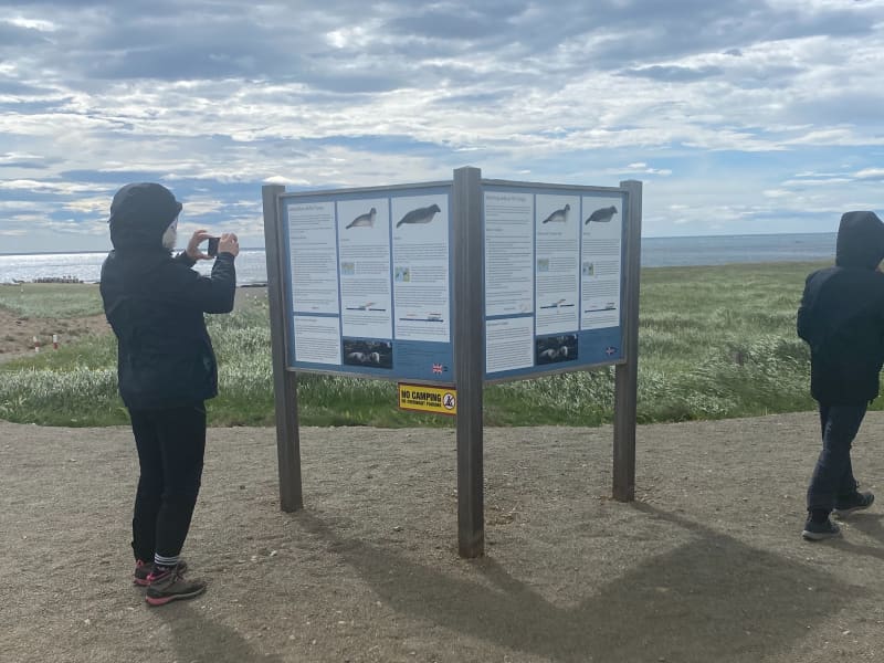
Ytri Tunga walking trail
Ytri-Tunga beach is first and foremost one of the best seal-watching spots in Iceland. Seals come here to hang around thanks to rocky shore where they can find a perfect combination of mainland and the close proximity of the safe ocean. A lot of work has been put in for brand new walking trails, from the car park to the shore.
Please bear in mind the following:
Please keep a minimum distance of 50 metres to the nearest seal. If pups are observed, a 100 m distance to the nearest seal is recommended.
If a seal makes a sound, moves or seems alert, it might be a sign of disturbance. In that case, move further away.
Females often leave their pups temporarily to go hunting. Plese do not attempt to access or touch the pups that appear to have been abandoned. Leave the pups alone so the mother can return to her offspring naturally.
Never position yourself between a seal and the ocean. It is important that the seal has easy access to the water to feel safe and secure.
When walking towards the seals, do so with slow and calm moves. Avoid loud noises and, if talking, keep your voice down. Leave the area in the same quiet manner.
Do not throw objects in the area close to the seals.
Avoid using camera flash when photographing.
Seal welfare may be negatively impacted by large groups of people in the seal habitat. On arrival, if you encounter a large group of people already close the the seals, please wait until some of the people leave.
Dogs are to be kept on leash at all times.
-------------------------------------------------------------------------------------------------------------------------------------------------
Area: Ytri-Tunga, Snæfellsnes
Road number to the starting point: Car parking at Ytri-Tunga, Snæfellsnesvegur (no. 54)
Level of difficulty: Easy/Moderate
Length: 1.67 km.
Elevation: 7 m.
Markings: Markings are on the route
Duration: 27 min.
Route type: Small rocks, mixed materials and grass
Obstacles on the way: There are steps on the trail
Service in the area: No service
Illumination: No illumination on the route
Season: The route is open all year round
GPS coordinates to the starting- and the finishing point: N 64°48.2310 W 023°04.8595
View
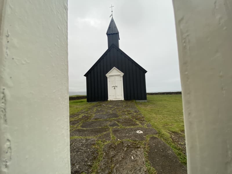
Búðir-Búðaklettur-Frambúðir
Búðir is located in the westernmost part of Staðarsveit in Snæfellsnes. At Búðir, there once was the most active tradingcenter at Snæfellsnes and a thriving fishing village, but archaeological remains have been found, for example at Frambúðir, indicating activities since the first settlement of Iceland. The vast lava field of Búðahraun stretches east towards the sea at Faxaflói and west to Hraunlandsrif.
The hike trough Búðir-Frambúðir and Búðaklett is a diverse nature experience. The nature of the area, combined with the history and monuments that exist, makes the hiking trail a unique experience. Trails are well marked, with bars and signposts along the trail but the trail from Frambúðir to Búðakirkja has few signpost but it is only a short trail betweenthe two. Búðahraun in on the natural heritage list of the Icelandic Environmental Protection Agency, but the area is one of the most popular destination in west-Iceland. Hótel Búðir is a popular choice when it comes to accommodation and catering, the church at Búðir is extremely popular for weddings and is the best known church in west-Iceland. The area around Búðir is a popular outdoor area, with golden coastline mixed with black coastlines and spectacular nature, topped off with the Snæfellsjökull glacier towering over the whole area.
Area: Snæfellsbær
Road number to the starting point: Turn off the highway nr. 54 (Snæfellsnesvegur), on to road nr. 574 (Útnesvegur)and there take the road to Búðir (Búðarvegur).
Difficulty level: Easy. Simple walking paths that a number of groups can enjoy.
Length: 6.8km
Elevation: 88 meters.
Markings: Markings are available.
Duration: 1.4 hours.
Route type: Small rocks, grass, lava field and mixed material.
Obstacles on the way: Steps are on the path.
Services in the area: Service is at hótel Búðir.
Illumination: No illumination.
Season: The route is open 12 months of the year.
GPS coordinates to the starting point: N64°49.3046 W022°23.0755
GPS coordinates to the finishing point: N64°49.3046 W022°23.0755
View
Grundarfjörður walking trail
Grundarfjordur at the Snæfellsnes peninsula is the hometown of Kirkjufell, which is one of the most famous mountains in Iceland, if not the whole world. The town of Grundarfjörður is surrounded by magnificent nature and wildlife and it is not uncommon for seals and killer whales to be seen in the fjord. Hiking trails can be found all around, up in the mountain range above the town, down by the coastline and within the town itself.
A walking trail within Grundarfjörður leads visitors to many interesting places and services, including the sports center and swimmingpool, art in Grundarfjörður and the beautifully shaped and place church, the information center, kayak rental, restaurants and cafés, accommodation, art studios and much more. Access on the trail is good and is being modified. Strollers and wheelchairs can use the entire trail, but part of the trail has fine gravel as route type. On the trail, you walk down to the coastline of Grundarfjörður, where you will find a magnificent view of Kirkjufell, the fjord and little island Melrakkaey and a variety of wildlife.
Area: Grundarfjörður (parking lot at Borgarbraut 17-19).
Road number to the starting point: Parking lot next to the gymnasium/swimmingpool.
Level of difficulty: Easy.
Length: 2.09 km.
Elevation: Less then 50 meters.
Markings: Services and companies will be marked on signs (from spring 2024).
Duration: 30 minutes.
Route type: Asphalt, concrete and parly fine gravel.
Obstacles on the way: No obstacles.
Service in the area: Camping ground is next to the route and toilets located at the camping ground, by the gymnasium/swimmingpool and in community hall at Sólvellir 3. Map of Grundarfjörður can be found around the town.
Illumination: Illumination is on part of the route.
Season: The route is open all year round but be aware of winter conditions on the route.
GPS coordinates to the starting- and finishing point: N64°55.3122 W 023°14.5813.
View
Borgarnes walking trail
While visitors are welcomed by the majestic and 4 million years old Hafnarfjall mountain, at the same time they can admire the imponent Snæfellsjökull glacier in the distance. Hvítá river runs along Borgarnes coastline and across Borgarvogur bay, you can have an overlook of the historic, Borg á Mýrum.
Borgarnes is the l argest urban centre in Borgarfjörður, with around 3.800 inhabitants. The town is a well-known resting place for domestic and foreign tourists, but even if you are travelling around the country and passing through Borgarnes, it is worht a visit, as there are many services available, whether it is in the form of accommodation, refreshments or activities and also many resting stops with beautiful views, information signs on the history of Borgarnes and about the ecosystem of Borgarvogur.
Borgarnes is on the beaten track, either if you are driving in the direction to Snæfellsnes or driving south to Reykjavík or north to Akureyri. Numerous hiking trails can be encountered in Borgarnes. From new walking paths, with access for carriages and wheelchairs, to hidden paths that are hidden in many places in between the residential areas of Borgarnes, all with different substrates, design and accessibility.
The hiking trail is connected to the campsite, sports ground and service area but it should be noted that it is needed to walk across highway no. 1 and there is no underpass or brigde. Skallagrímsgarður, Vigdísarlaut, Granastaðir, Vesturnes, Suðurnes, Miðnes, Bjössaróló , Hlíðartúnshús and Hjálmaklettur are some examples of fun areas connected to the hiking trail around Borgarnes.
Area: Borgarnes, Borgarbyggð
Address of the starting point: Brákarbraut 15, Borgarnes
Level of difficulty: Easy.
Length: 9.89km/6.14 miles.
Elevation: 50-100 meters/164-328 ft.
Markings: No markings.
Duration: 2 hours.
Route type: Mud and small rocks substrates.
Obstacles on the way: Several small steps are on some paths.
Services in the area: Services around the area and in the camping site in Granastaðir, Borgarbyggð information center.
Illumination: Part of the route is illuminated.
Season: The hiking trail is open all year round.
GPS coordinates starting point: N64°53523 W021°923
GPS coordinates finishing point: N64°53523 W021°923
View
Reykholt saga circle trail
Hiking around Reykholt saga ring trail is educational and fun. An extensive work has been done on installing signs and build footpaths, making it possible to walk into Reykholtsskógur which is located above the village. It's possible to download an audioguide that adds more fun when walking around the area.
Reykholt in Borgarfjörður is a well-known village for tourists and locals. An ancient and protected pool, Snorralaug, is located in this area. According to Landnáma (the oldest book of the Settlement in Iceland), Snorralaug has been there since 960. In Reykholt is also possible to visit two churches. Reykholtsskógur "forest" is above the churches and there is an ancient highway that passes through and along the forest. Snorrastofa is a research centre where it is possible to get information about the area and where you can find guided tours, lectures and exhibitions. There is also a shop with unique products and gifts. The area has a lot to offer, specially to visitors in search of nature and/or history. Reykholt Festival is held every year at Reykholt.
Area: Reykholt, Borgarbyggð
Road number to the starting point: Hálsasveitarvegur (nr. 518), Borgarbyggð
Level of difficulty: Easy
Length: 1.64km/1 mile
Elevation: 50 meters elevation/164 ft.
Markings: No markings on the way
Duration: 25 minutes
Route type: Small rocks and a paved path
Obstacles on the way: No obstacles
Services in the area: Toilet is accessible on the route, garbage can be dumped in bins on the way and there is an option to buy guided tour of the route. Snorrastofa provides some services and there is also Fosshótel Reykholt that offers accommodation, restaurant and assistance providing information to visitors.
Illumination: Part of the route is illuminated
Season: This hiking trail is open all year round
GPS coordinates starting point: N64°66318 W021°292
GPS coordinates finishing point: N64°66318 W021°292
View
Frístundastígur; Ólafsvík-Rif-Hellissandur
In 2013 the first part of the path was laid between Hellissandur and Rif. A path was subsequently laid between Ólafsvík and Rif in 2014 and it was paved in 2017. A bridge was placed over Höskuldsá in 2020 and is now connected to Ólafsvík-Rif-Hellissandur with a hiking and cycling path. The path is widely used by the local population.
When hiking on Frístundastígur, guests have the opportunity to connect to the pure nature. The path is paved and a diverse group of people can use it. Some parts of the walk are along the coastline, making it possible to admire the beauty of Svöðufoss Waterfall and Snæfellsjökull Glacier. The bird life is abundant in the area and when going down to the Keflavík Cliffs, there is a great spot for bird life observation ad bird life is in its plentitude, and the arctic tern is the most common bird in the area.
Area: Ólafsvík-Rif-Hellissandur
Road number to the starting point: Útnesvegur (nr. 574)
Level of difficulty: Easy
Length: 19.26 km/11,96 miles
Elevation: 50 meters/164 feet
Markings: No markings, however the route is very clear
Duration: Approximately 1 hour and 20 minutes on bike
Route type: Asphalt
Obstacles on the way: No obstacles along the way
Services in the area: Services available in Ólafsvík, Rif and Hellissandur
Illumination: Part of the route is illuminated
Season: This hiking trail is open all year round
GPS coordinates starting- and finish point: N64°53.3401 W023°41.2849
View
Eldborg Crater hiking trail
Eldborg is a typical crater that rises 60 meters above the surrounding lava and is the largest crater within short fissure. The crater is oval, above 100 meters in diameter and 50 meters deep. The walls are steep and made of ultra-thin layer of lava. Eldborg was declared protected natural monument in 1974.
The trail up to the crater is diverse. Beautiful lava formations can be found on the way while walking. From the Crater's top it is possible to contemplate magnificent views in all directions, and specially if there is good weather conditions and good visibility, it is even possible to observe the fjords from the Snæfellsjökull Glacier, all the way to Reykjanes.
The trail begins in Snorrastaðir's service area, where you can find accommodation along with facilities for groups, all sizes and types. The trail is composed with different surfaces but the majority of the trail is on lava substrate.
When going up the Eldborg's hillside, it is possible to use chains that are available there to assist hikers going up or down.
Area: Hnappadalur, Borgarbyggð
Road number to the starting point: Snæfellsnesvegur (nr. 54), Snorrastaðir
Level of difficulty: Easy, however it should be noted that there are lot of high steps on the way
Length: 6.64km / 4.12 miles
Elevation: 50-100 meters / 164-328 ft.
Markings: Little markings on the way
Duration: Approx. 1 hour and 27 minutes
Route type: Small and large rocks, lava and mulch substrates
Obstacles on the way: There are a lot of steps to find on the way / it can be difficult to find the way
Services in the area: A toilet is available on the way and trash can be deposited in Snorrastaðir service area
Illumination: Part of the route is illuminated, from Snorrastaðir until the beginning of the trail
Season: The hiking trail is open all year round
GPS coordinates starting- and finishing point: N64°46.4456 W022°18.1262
View
Tröð forestry
The walking trail through Tröð forestry is funand varied. The forestry is a beautiful and good place to enjoy the environmentand enjoy being together. The forestry trail is a fun outdoor trail where youcan assess a campsite, the Maritime Museum and the new building of Snæfellsjökullregional park.
In 1950, Kristjón Jónsson started farming inTröð by Hellisandur. A beautiful area that stood in the lavafield and becamepopular early on among forest-and arboriculture enthusiast. In 2002, the Forestryand Land porection association under the Snæfellsjökull signed an agreementwith Snæfellsbær to take over the management of the area, based on a specialcooperation agreement. The area is well sheltered, an ideal place to enjoy thesurroundings and use the hiking trail that connect the forestry to thecampsite, the sports area, the Maritime museum and Snæfellsjökull regionalpark. Tröð forestry is an „Open forest“, as it was officially open in 2006.Accessibility and facilities are exemplary but into the forest you can findmany hiking trails, resting places, informations and facilities for cooking.The forest is surrounded by a rock-filled fence, but beyond the fence there aremore hiking trails in the surrounding area. Snæfellsjökull shines brightly fromthe forestry and the hiking trail around the lava field is a fun experience.
Area: Snæfellsbær.
Road number to the starting point: Útnesvegur (nr. 574).
Difficulty level: Easy/light.
Length: 2.08km.
Elevation: 0-50 meters.
Markings: No markings.
Duration: 27 minutes.
Route type: Paved paths, small rocks, grass, lavafield and wood sticks.
Obstacles on the way: Steps over the rock-filled fence and steps when walking to the Maritime museum.
Service in the area: Maritime museum and the Snæfellsjökull regional park.
Illumination: No illumination.
Season: The hiking trail is open all year round.
GPS coordinates to the starting point: N 64°31.2295 W021°26.3108
GPS coordinates to the ending point: N 64°31.2295 W021°26.3108
View
Fossatún hiking trail
Fossatún is a well-known destination in Borgarfjörður, where you can find hiking trails related to folklore heritageand troll books, written by the local keeper, where the stories are set in west Iceland. Fossatún is located in between large summer house areas, where Skorradalur and Húsafell lie on either side of Fossatún. Grímsá river runs nextto Fossatún and you can also find spectacular views of the mountain range of Borgarfjörður at Fossatún.
Fossatún is located about 90 km from Reykjavík, on road no.50, halfway between Borgarnes and Reykholt in Borgarfjörður. Different accommodation facilities are available at Fossatún, from campsites, cottages, guesthouses and country hotel. There is a restaurant as well as facilities for guests to cook, and everyone has access to hot tubs. Fossatún is located on the banks of Grímsá river and has hiking trails along the riverside area, but there is also a hiking trail to Blundsvatn lake, where you can find diverse bird life and a beautiful view of Borgarfjörður´s mountain range.
You can walk from the service area at Fossatún and walk along Grímsá river, where you can find information signs, including sign about the saga´s, legends and trolls. The trail is very visable and accessible for a wide range of guests. The trail to Blundsvatn lake is quite visable but the accessibility is not for as wide range of guests. Grass paths with someparts on gravel is located on the trails but the trail connects the Blundsvatn lake to the Fossatún area.
Area: Fossatún, Borgarbyggð.
Road number to the starting point: Borgarfjarðarbraut (nr. 50).
Level of difficulty: Easy.
Length: 1.75km trail at Fossatún and 3.13km at Blundsvatn lake. Together: 4.8 km
Elevation: 47 meters at Blundsvatn lake and 60 meters at Fossatún. .
Markings: Markings are visable, with information signs and rock formations plentiful.
Duration: At Fossatún is 32 minuets and Blundsvatn lake 40 minuets. Together: 1.2 hours.
Route type: Small rocks and mixed materials.
Obstacles on the way: No obstacles on theroute.
Service in the area: The main service/information house at Fossatún.
Illumination: No illumination.
Season: The route is open except when temporary closed due to bad weather over the winter time or due to bird nestingtime.
GPS coordinates to the staring-andfinishing point: N64°35.5672 W021°34.6263
View

Varmaland hiking trail
Varmaland is a small village that has been built around geothermal area in Stafholtstungur in Borgarbyggð. The settlement is located in between Hvítá river and Norðurá river, with a kindergarten, swimming pool and a gymnasium. Laugaland, which is a small farm in the area that uses the geothermal energy for gardening, but cucumbers are grown there all year round. Hotel Varmaland is located in the heart of the village and Varmaland is a popular place to visit and to stay.
Varmaland in Borgarbyggð is a well-known place for tourist, both domestic and international. Varmaland´s campsite has been known among domestic tourists for years, but with the arrival of Hotel Varmaland, more foreign tourists have been introduced to the area. Varmaland is clearly visable from highway no. 1, but the lights and the steam coming fromthe area is very visable. The trail through Varmaland is located in forestry, on the cliffs above Varmaland but from there, you will find great views over the surrounding areas. The trail starts at Hotel Varmaland but turns into theforestry, where you can find a playground for younger generation but also numerous walking and hiking paths. A variety of paths, together with a beautiful landscapes, makes a walk through Varmaland, a very interesting and fascinating experience.
Area: Varmaland, Borgarbyggð.
Road number to the starting point: Hotel Varmaland (no. 527 Varmalandsvegur).
Level of difficulty: Easy.
Length: 5.03km
Elevation: 75 meters.
Markings: Markings can be found.
Duration: 1.07 hours.
Route type: Mixed, small rocks, grass.
Obstacles on the way: Steps on the way.
Services on the way: Hotel Varmaland and gymnasium/swimming pool at Varmaland.
Illumination: No illumination.
Season: The trail is open all year round.
GPS coordinates starting point: N64°21.2886 W021°36.6383
GPS coordinates finishing point: N64°21.2886 W021°36.6383
View
Barnaborgir hiking trail
Barnaborg lavafield is a wavy Aa lava field from modern times, where heather and scrub have grown, flowed from Barnaborg. Volcanic cone was in the middle of the lava, but Barnaborgir are two lava hills standing in the middle of the lava field. A fun outdoor area with hiking trail around the lava where you can enjoy the area, the silence and the beauty of Snæfellsnes and Borgarbyggðar at the same time. The Environment agency of Iceland (ust.is) has Barnaborgir on the natural heritage register list.
The path through the Barnaborg lava field is visable, but from the parking lot there are steps over a fence, but then visitorsare faced with a clear path that leads visitors into the lava field. When entering the lava field, narrow paths are visable that can be dangerous, but visitors must ensure good footwear before entering the lava field. The area around the lava hills is majestic, where visitors can walk around the area and enjoy the environment, nature and tranquility that the area has to offer.
Area: Borgarbyggð.
Road number to the starting point: Road no.54 (Snæfellsnesvegur).
Level of difficulty: Easy path.
Length: 2.8km
Elevation: 107 meters.
Markings: Markings can be found.
Duration: 45 minutes.
Route type: Small rocks, grass, lava field.
Obstacles on the way: Steps are on the paths.
Services on the way: No services.
Illumination: No illumination.
Season: The trail is open all year round but be aware of winter conditions before hiking.
GPS coordinates starting point: N64°45.3335 W022°14.9905
GPS coordinates finishing point: N64°45.3335 W022°14.9905
View
Helgafell hiking trail
Helgafell is a basaltic rock mountain located just outside Stykkishólmur. At the foot of the mountain there is a parking lot with signs related to the history of the place and the whole approach is exemplary. At the beginning of the hike, you walk through a gate, but then a footpath leads hikers up to a viewing disc and a piled rock formation that can be found at the top of Helgafell.
Helgafell in Helgafellssveit is a famous and ancient ground, but it is featured in some ancient Icelandic stories, some ofwhich are believed to have been written at Helgafell. There is a lot of history attached to the area and a magnificant view from the top of Helgafell, where you can see over the Breiðarfjörður bay and the mountains of Snæfellsnes. Oldfolklore says that those who walk Helgafell for the first time, have the option of making three wishes when they reach the top of the mountain. The criteria are that you walk in silence to the top and do not look back. When you reach the top, you look to the east and make three wishes in your mind and tell no one.
Area: Helgafell, Helgafellssveit.
Road number to the starting point: Helgafellsvegur (from Stykkishólmvegur no.58).
Level of difficulty: Easy path.
Length: 500 meters.
Elevation: 73 meters.
Markings: No markings.
Duration: 10 minutes.
Route type: Small rocks, mixed materials, large rocks and tree curls.
Obstacles on the way: Steps are on the paths.
Services on the way: At the car parking area there are garbage bins and toilets.
Illumination: No illumination.
Season: The trail is open all year round but be aware of winter conditions before hiking.
GPS coordinates starting point: N65°02.5055 W022°43.9716
GPS coordinates finishing point: N65°02.5055 W022°43.9716
View
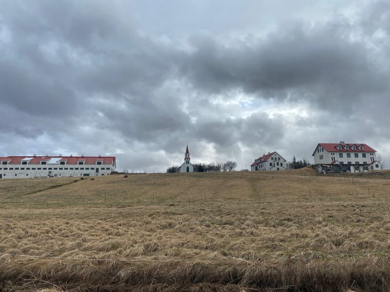
Hvanneyri walking trail
Hvanneyri is a small, growing urban area in Borgarfjörður, where the headquarters of the Agricultural University of Iceland (LBHÍ) is located, but also where the Agricultural Museum of Iceland is located, the store Ullarsel and Hvanneyratorfan, which are the old schoolhouses in Hvanneyri. The trail goes out to Andakílsá, a protected area of the Environment Agency, a Ramsar site, that is a bird sanctuary around Hvanneyri. Hvanneyrartorfan is a protected area of the Heritage Foundation, but in addition, the Agricultural University of Iceland has taken care of the maintenance of footpaths in the area as well as volunteers. There has been a lot of development in hiking trails and outdoor recreation areas in Hvanneyri and has a wide attraction for outdoor enthusiasts.
Hvanneyri has history, nature and outdoor activities to offer. The bird life in the area is varied, but the attraction ofwildlife has drawn many tourists to see the whitefronted goose, whose protected area is in Hvanneyri. Torfan attracts visitors to Hvanneyri, but the old school buildings are still in use and have different functions, such as a cafe, sportshall, museum building and apartments for the teachers of the University of Agriculture.
Hvanneyrartorfan is on the Icelandic Heritage Foundation's list of protected buildings and structures, but they areHvanneyrarkirkja (built in 1905), School House (built in 1910), School Principal's House (built in 1920), Skemman (built in 1896), Gymnasium (built in 1911), Hjartarfjós ( built between 1900-1901), Halldórsfjós and barn (builtbetween 1928-1929) and Vélahús. The Environment Agency protected Hvanneyri as a habitat for birdlife in 2002, but then expanded the area in 2011 and was then named Andakíll. The goal of conservation was and is to protect the wetlands found there, which are the habitat of numerous bird species.
The trail starts at the parking lot of the Icelandic Museum of Agriculture and goes towards LBHÍ, heading out to Andakílsá. The trail joins the main road in a small section, but otherwise you walk on dirt roads, mats, paved paths, tree trunks and some rocks.
From April 20 to July 20 is the nesting season for birds, so visitors to the area are advised to pay special attention to birdlife in the protected area. Dogs/cats are not allowed to roam freely in the area.
Area: Hvanneyri, Borgarbyggð.
Road number to the starting point: Agricultural Museum of Iceland (Hvanneyrabraut no.53).
Level of difficulty: Easy path.
Length: 8.77km
Elevation: 12 meters.
Markings: Path is marked but not everywhere.
Duration: 1.46 hour.
Route type: Small rocks, mixed materials and tree curls.
Obstacles on the way: Steps are on the paths.
Services on the way: At the Agricultural Museum, at the Ullarsell store and at the LBHÍ.
Illumination: No illumination.
Season: The trail is open all year round but it is important to stay on the trail from 20th of April to 20th of July each year because of the nesting season in the area.
GPS coordinates starting point: N64°33.8794 W 021°45.9281
GPS coordinates finishing point: N64°33.8794 W 021°45.9281
View
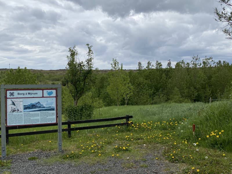
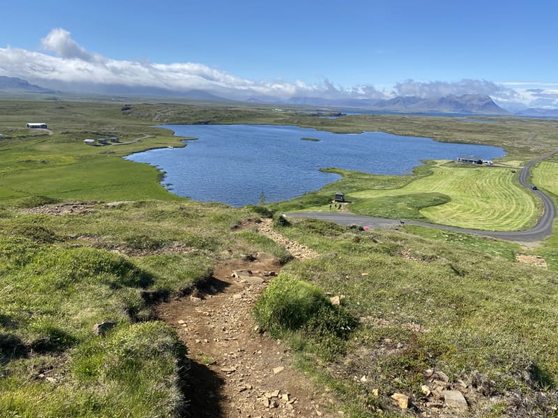
Borg á Mýrum-Einkunnir hiking trail
Borg á Mýrum is a church site located west of Borgarnes. The place is, according to Egil Skallagrímsson's story, a settlement ground, but a church has stood there since 1002. Borg á Mýrum is a well-known place as a destination for tourists, whether they are foreign or domestic tourists. The church site has welcomed foreign visitors for years, but visitors have then been guided around the area and have been allowed to see the church under the guidance of the priest at Borg. The artwork Sonatorrek and a view of Borgarnes and Hafnarfjall faces visitors who come to the church.
Einkunnir country park are a 273 hectare country park that can be found north of Borgarnes. Forestry has been theresince 1951, but within the country park there is a beautiful pond, Álatjörn, along with a number of footpaths, resting places and beautiful forestry, which makes Einkunnir one of the pearls of Borgarbyggð. Monuments are on the trail atBorg á Mýrum but also on the hiking trail between Borg and Einkunnir. In 2015, the registration of relics along the trail began, but there you can find relics of a sheep stable, a shepherd's house, a shelter and more. Hikers are asked torespect the relics that are found.
The trail is marked all the way, but keep in mind that in many places it is difficult to cross ditches and swamps along theway. The trail between Borg á Mýrum-Einkunnir offers a magnificent view of Hafnarfjall and Borgarnes along with the beautiful wildlife that can be found along the way.
Area: Borg á Mýrum/Einkunnir country park, Borgarbyggð.
Road number to the starting point: Parking lot by Borg á Mýrum(road no.54).
Level of difficulty: Moderate.
Length: 5.26km.
Elevation: 123 meters.
Markings: Markings on the trail.
Duration: 1.30 hours.
Route type: Small rocks, mixed materials, and grass.
Obstacles on the way: There are steps on the trail.
Service in the area: Toilets are accessible at Einkunnir.
Illumination: No illumination.
Season: The route is open all year round but be aware of winter condition on the route.
GPS coordinates to the starting point: N64°33.6630 W021°54.9579 (At Borg á Mýrum)
GPS coordinates to the finishing point: N64°35.8993 W021°54.6785 (Ends at Einkunnir).
View
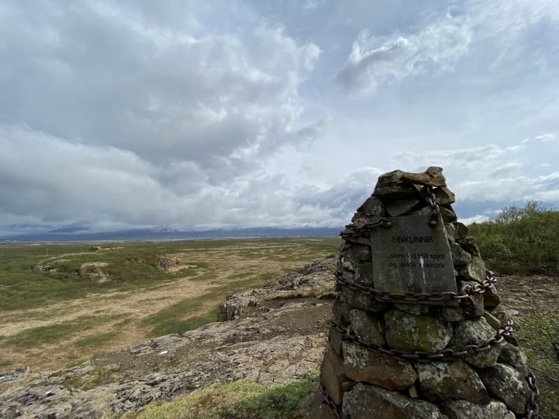
Einkunnir hiking trail
In Einkunnir you can find a very diverse landscape, animal-and plant life. The area was protected as a country park in2006, but the goal of the area's protection is to protect the wetlands and geological formations that the public can use for education, outdoor recreation and nature viewing. There are hiking trails throughout the area, and you can find difficult slopes mixed with easy paths in the lowlands. The three rock clusters that rise from the marshland are clearly visible in the distance, but up from Syðri-Einkunnir there is a viewing platform, where you can see the mýrar area,Borgarfjörður and Borgarfjarðadali.
Turn off highway no. 1 and onto road no. 536/3. A road leads to a parking lot at Einkunnir. There you will find information boards about the area's wildlife, along with numerous starting points for hiking trails. The accessibility of carriages and wheelchairs can be found on several routes, but most routes are narrow and there are many inclines. There is a connection to a hiking trail to Borg á Mýrum, but there is also an outdoor recreation area in Einkunnir, where there is a grill, benches and tables. Álatjörn pond together with the number of footpaths, resting places and beautiful forestry makes Einkunnir one of the pearls of Borgarbyggð.
Area: Einkunnir country park, Borgarbyggð.
Road number to the starting point: Parking lot by the forestry (road no.536/3).
Level of difficulty: Easy/Moderate.
Length: 5.2km.
Elevation: 70 meters.
Markings: Markings can be found on the way but needed at times.
Duration: 1.17 hours.
Route type: Small rocks, mixed materials, and grass.
Obstacles on the way: There are steps on the trail.
Service in the area: Toilets are accessible.
Illumination: No illumination.
Season: The route is open all year round but be aware of winter condition on the route.
GPS coordinates to the staring-and finishing point: N64°59824 W021°911
View
Bárður Snæfellsás walking trail
Arnastapi is a well-known tourist destination around Snæfellsnes and there has been some development in the area in recent years. Some walking paths around the area are now easily accessible, and there are a large number of restaurants and accommodation facilities in the area. The harbor at Arnastapa and the hiking trails between Arnastapa and Hellnar are destination/resting places. The environment as a whole in the area is unique, where the bird life, combined with the diverse landscape, makes Arnarstapi one of the most popular destinations in the West. The large loaded image of Bárði Snæfellsás by Ragnar Kjartansson towers over the area and the coastline of Arnarstapa.
Area: Bárður Snæfellsás, Arnarstapi. Snæfellsnes.
Road number to the starting point: Arnarstapavegur (no. 5710).
Level of difficulty: Easy.
Lenght: 1.18km.
Elevation: 30 meters.
Markings: No markings.
Duration: 18 minutes.
Route type: Mats and small rocks.
Obstacles: No obstacles.
Services in the area: Toilets and garbage bins are available.
Illumination: No illumination.
Season: The trail is open all year, but it is advised the the path may be slippery due to ice during the winter.
GPS coordinates starting-and ending point: N64°45.9992 W023°37.7660
View
Beruvík hiking trail
The beginning of the hiking trail is at the parking lot at Beruvík. The trail leads through the ruins of houses that used to be in Beruvík and the path is well marked. It is said that a woman named Bera lived in Beruvík. In Beruvík there were two lands, Garðar and Hella. Nýjabúd, Bakkabúd and Helludalur were sublet. The land was difficult for farming because small fields and lava made it difficult for farmers. However, it was sheltered and good grazing all year round. Farmers fetched the sea from Beruvík and used the driftwood from the ocean. The settlement ceased in the middle of the 20th century. The walk through Beruvík, you pass between town ruins, but you can see, among other things, sheep bath where sheep were bathed due to itch mite in sheep, Nýjabúd ruins and various ruins while Snæfellsjökull towers over visitors.
Area: Beruvík, Snæfellsjökull national park.
Road number to the starting point: Útnesvegur (no. 574).
Level of difficulty: Moderate.
Lenght: 1.17km.
Elevation: 7 meters.
Markings: Markings are visable.
Duration: 18 minutes.
Route type: Lava field and grass.
Obstacles: Trails are narrow, grass paths, and mixed surfaces.
Services in the area: No services.
Illumination: No illumination.
Season: The trail is open all year, except in the months March and April.
GPS coordinates starting-and ending point: N64°48.7933 W023°57.6929
View
Eyrarhringur hiking trail
Eyrarhringur is located in the protected area, Snæfellsjökull National Park. The national park is located on the outskirts of Snæfellsnes, but its purpose is to protect the special nature of the area and the monuments that can be found, but also the goal is to make it easier for people to travel around the area and get to know it. The coastline at Eyrar and Snæfellsjökull are a major part of the experience for visitors to the area, but the monuments in the area are also bulky. There are two hiking trails from the parking lot, one to Öndverdaneshólar and the other to Eyrahringinn.
Eyrahringur is an easy trail. The path leads down to the sea and mostly through lava field. There are beautiful ponds in the lava and there are various types of birds in the area. Along the way, you can see relics of the settlement in many places. There are ruins at Stóru-Eyri but that area was inhabited there until the middle of the seventeeth century.
Area: Eyrar, Snæfellsjökull national park.
Road number to the starting point: Útnesvegur (no. 574).
Level of difficulty: Moderate.
Lenght: 6km.
Elevation: 50 meters.
Markings: Markings are visable.
Duration: 1.3 hours.
Route type: Lava field and grass.
Obstacles: Steps and rough surface.
Services in the area: No services.
Illumination: No illumination.
Season: The trail is open all year, except in the months March and April.
GPS coordinates starting-and ending point: N64°49.3462 W023°57.9035
View
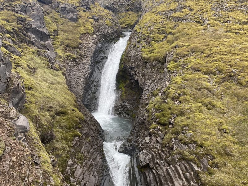
Klukkufoss waterfall hiking trail
Klukkufoss waterfall is located in Eysteinsdal in Snæfellsnes. The trail is quite short but challenging, where you walk up a steep hill to the basalt formed mountain Klukka and Klukkufoss waterfall falls amidst beautiful basalt colums formations. On the hike up to Klukkufoss , there is a chance to enjoy the view of the surrounding countryside, but the rock formations catch the attention of visitors along with the beautiful Klukkufoss. Klukkufoss hiking trail is one of 35 hiking trails that have been put up in the hiking trail brochure for the Snæfellsjökull National Park, and there you can find information about the km length of the hiking trail, the duration of the hiking trail and information about the markings on the hiking trail. When walking up to Klukkufoss, there is a view down to Öndverðarnes and Saxhól, together with the proximity of Snæfellsjökull and a view of the surrounding countryside.
Area: Klukkufoss, Snæfellsjökull national park.
Road number to the starting point: Útnesvegur (no. 574). Eysteinsdalsvegur (F575).
Level of difficulty: Moderate.
Lenght: 0.94km.
Elevation: 58 meters.
Markings: Markings are visable.
Duration: 13 minutes.
Route type: Lava field, grass and small rocks.
Obstacles: Steps are on the path.
Services in the area: No services.
Illumination: No illumination.
Season: The trail is open all year, but it is advised the the path may be slippery due to ice during the winter and the areais wet with mud during March until May.
GPS coordinates starting-and ending point: N64°52.1791 W023°51.6872
View
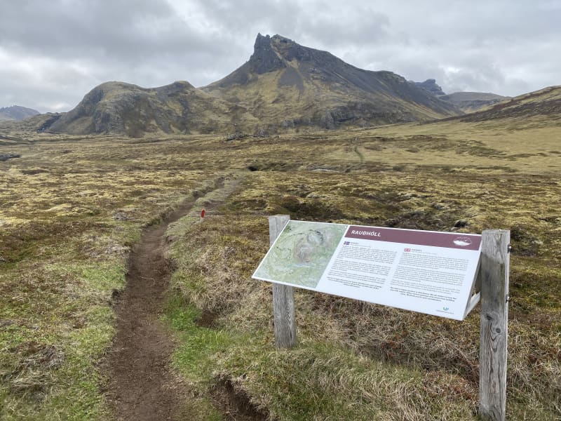
Rauðhóll hiking trail
From the crater Rauðhóll, lava flowed into the sea, all the way from Hellisandi to Skarðsvík. A marked path leads from the parking lot at Eysteinsdalsvegur to Rauðhóll, with the hiking trail going over an old lava field along with grass and small rocks, next to beautiful ponds that have formed around the area. Rauðhóll is in the protected area of theIcelandic Environment Agency, and you should keep in mind to avoid off-trail walking, in order to protect the area from trampling. Rauðhóls trail is one of 35 trails that have been put up in the trail brochure for SnæfellsjökullNational Park, and there you can find information about the length of the trail in km, the duration of the trail and information about trail markings. When hiking up Rauðhól, the view down to Öndverðarnes and Saxhól, together with theproximity to Snæfellsjökull, is great and the view of the surrounding countryside is also immense.
Area: Rauðhóll, Snæfellsjökull national park.
Road number to the starting point: Útnesvegur (no. 574). Eysteinsdalsvegur (F575).
Level of difficulty: Moderate.
Lenght: 2.83km.
Elevation:103 meters.
Markings: Markings are visable.
Duration: 43 minutes.
Route type: Lava field, grass and small rocks.
Obstacles: Steps are on the path.
Services in the area: No services.
Illumination: No illumination.
Season: The trail is open all year, but it is advised the the path may be slippery due to ice during the winter and the areais wet with mud during March until May.
GPS coordinates starting-and ending point: N64°52.1638 W023°52.8236
View
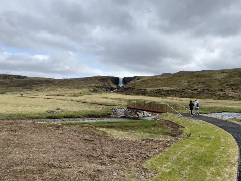
Svöðufoss waterfall walking path
Svöðufoss in Snæfellsnes is a beautiful waterfall in Hólmkelsá, not far from the town Rif. The waterfall is 10 meters high and falls from a beautiful basalt pillar rock. A parking lot has been built in the vicinity of the waterfall, mats-and iron walking paths have been installed to give access to strollers and weelchairs, all the way to the waterfall.
Area: Snæfellsnes (between Rif and Ólafsvík).
Road number to the starting point: Útnesvegur (no. 574) and turn to the Svöðufoss waterfall.
Level of difficulty: Easy
Length: 1.18km
Elevation: 20 meters.
Markings: No markings.
Duration: 17 minutes.
Route type: Mats-and iron walking paths.
Obstacles on the way: No obstacles.
Services in the area: No service.
Illumination: No illumination.
Season: The route is open all year round.
GSP coordinates start-and ending: N64°54.0155 W 023°48.6369
View
Jafnaskarðsskógur forestry hiking trail
Jafnaskarðsskógur forestry is one of Vesturland's outdoor recreation secrets. A footpath was first laid around the forest in 1995, but since then it has been well maintained and the forest is connected to other interesting walking paths. Jafnaskarðsskógur is located on the slope southwest of Hreðavatn, but the view from the hills above the forest is magnificent. A view of Eiríks-and Langjökull glaciers, Hreðavatn lake and the surrounding countryside as well as a view to Skjaldbreið mountain and Botnssúla mountains in the distance.
Turn off highway no. 1 at Grábrókarhraun and drive to Hreðavatn lake. Drive past summer cottages on the way before arriving to a well-marked parking lot. The walking paths are varied, with steep slopes mixed with easy paths. The trails are not marked but very visable and have been well maintained. There are many viewpoints in the area, as well as resting places, with tables and benches. Visitors can spend a whole day in this area, but there are also many natural beauties close to Jafnaskarðsskóg forestry, such as Grábrók, Glanni waterfall and Paradísarlaut.
Area: Jafnaskarðsskógur forestry, Borgarbyggð.
Road number to the starting point: Parking lot by the forestry (road Hreðavatn no. 5258).
Level of difficulty: Moderate.
Length: 2.47km.
Elevation: 141 meters.
Markings: No markings.
Duration: 40 minutes.
Route type: Small rocks and grass.
Obstacles on the way: There are steps on the trail.
Service in the area: No service.
Illumination: No illumination.
Season: The route is open all year round but be aware of winter condition on the route.
GPS coordinates to the staring-and
finishing point: N64°45.3059 W021°35.7743
View
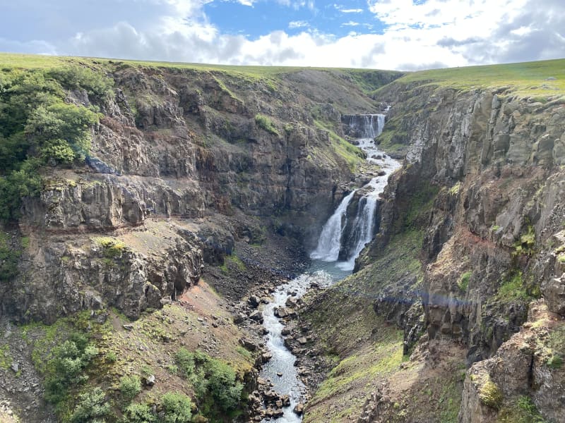
Rauðsgil hiking trail
Rauðsgil gorge in Borgarfjörður is on the border between Hálsasveit and Reyholtshrepss. The gorge is deepest at the bottom of the river, as it reaches from 60 to 70 meters deep but becomes shallower as it gets higher up the river. There are large number of waterfalls in the river, including Laxfoss, Einiberjafoss, Tröllafoss and Bæjarfoss waterfalls. The first part of the trail gives hikers a view of high waterfalls, with options to walk along the edge but also on a visable trail further from the edge. As hikers get upriver, the experience of the tranquililty and closeness to the river and waterfalls is breathtaking.
Rauðsgil gorge is a little known place for domestic and foreign tourists that can be a good addition to the nature experience that is available in this area. The experience of visitors who visit and hike Rauðsgil gorge can be great, with the views of the mountain range around Rauðsgil, along with the sounds of the waterfalls. The hike is relatively easy, but there is no climbing along the trail but visitors can choose between the tractor trail further from the gorge or closer to the gorge, but visitor must be aware of the risks if the terrain is slippery or wet. Visitors with dogs are kindly asked to keep them on a leash when the sheep is free in the area, between 1st of June and 30th of September. Larger cars or buses are directed to Rauðsgilsrétt.
Area: Rauðsgil, Borgarbyggð
Road number to the starting point: Gravel pit near Steindórsstaðir farm (road no. 5150).
Level of difficulty: Moderate.
Length: 4.16km.
Elevation: 252 meters.
Markings: No markings.
Duration: 1 hour and 21 minutes.
Route type: Small stones, large stones and grass.
Obstacles on the way: There are steps on the way.
Services in the area: No service in the area.
Illumination: No illumination on the hiking trail.
Season: This hiking trail is open all year round but it is advised that the trail may be slippery due to ice during winter and the area is wet with mud during March until May. The trail is open all year round except when the sheep are herded from the slopes and mountains. 1-2 days a year in September. Informations are by the gate.
GPS coordinates starting- and finish point: N64°39.3434 W021°13.7068
View