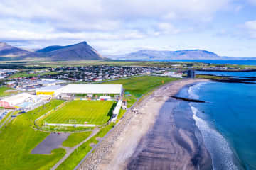
Garðalundur Akranes forestry


At Akranes, you can find three fun hiking trails through forestries. One is in Garðalund, one in Klapparholt and one in
Slaga. Garðalundur has a variety of recreational opportunities for the residents and visitors of Akranes, Klapparholt is a forest where you can find many different types of vegetation, such as birch and pine and at Slagi forest,
which is located at the roots of Akrafjall mountain, where visitors can find different walking trails, along with different plant life and fantastic views over Akranes and Faxaflói bay.
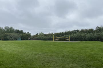
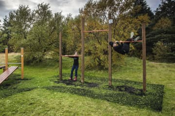
In Garðalund you can find a variety of recreation for residents and visitors of Akranes. Volleyball court, frisbee
golf course, exercise equipment, resting places, cabin, walking trails and information boards. A flourishing social area, with infrastructure like toilets and garbage bins, where visitors can enjoy the many recreational options that
can be found in Garðalundur.
Entering Klapparholt, you can find several information sign about the area and the couple Guðmundur Guðjónsson and
Ragnhildur Árnadóttir, who started cultivation and organization in the area in 1988. You can also find „Klapparholtið“, but it is in the middle of the forestry. There are stories that an elf church and hidden people live in the „Klapparholt
church“ that stands there. It is popular for outdoor enthusiasts to use the area for walking, running or cycling.
In Slaga forestry you can find resting places and infrastructure like toilets and garbage bins, but is addition there is a
great view of Akranes and the surrounding area. There is a trail from Slaga to the starting path up Akrafjall, but it is also popular for outdoor enthusiasts to use the area for walking, running or cycling.
Area: Akranes
Road number to the starting point: At Garðalund (Klapparholtsvegur) inside Akranes.
Difficulty level: Easy. Accessibility for wheelchairs and wagons but on some trails, the accessibility is not available.
Length: 12.31 km
Elevation: 50-100 meters.
Markings: There can be found marking in some of the areas but not in-between the areas. The paths are very visible.
Duration: 2.23 hours.
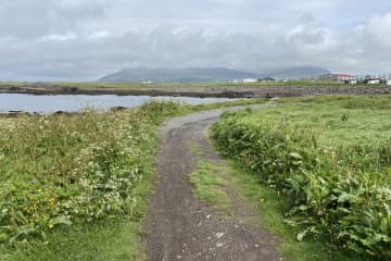
Route type: Small rocks, grass and mixed material.
Obstacles on the way: No obstacles inside Garðalundur and Klapparholt but there are steps and difficult grass paths in Slaga.
Services in the area: At Garðalund and at Slaga.
Illumination: Some illumination between the forestries.
Season: The walking trail is open all year round.
GPS coordinates to the starting point: N64°19.3052 W022°02.2243. At Garðalund.
GPS coordinates to the finishing point: N64°19.9648 W021°58.8807. At Slaga.

